Panhandle Offshore Fish and Dive Chart 90F
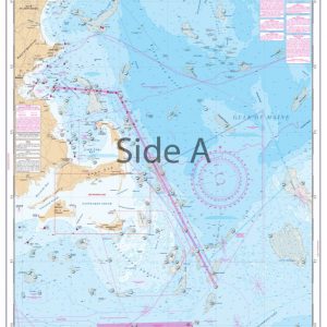
The Area Covered
No valid coordinates found for this map.
$32.95
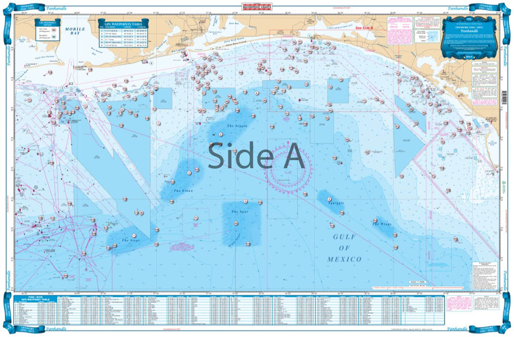
Offshore coverage from Cape San Blas west to Dauphin Island, Alabama and south to 29 degrees north latitude (77 miles south of Destin). Features enhanced bathymetric contour lines in famous Billfish areas; “The Nipple”, “The Spur”, “The Steps”, “The Elbow”, “Desoto Canyon”, and others – with GPS coordinates.
The Area Covered
No valid coordinates found for this map.
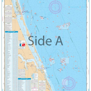
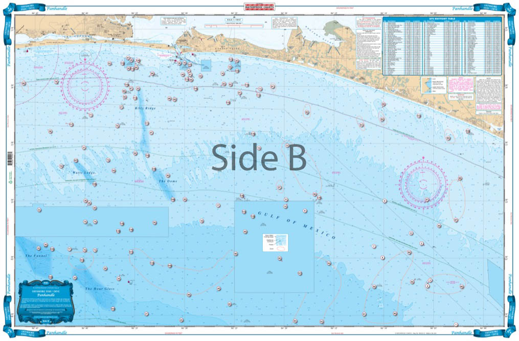
Offshore coverage from Cape San Blas west to Dauphin Island, Alabama and south to 29 degrees north latitude (77 miles south of Destin). Features enhanced bathymetric contour lines in famous Billfish areas; "The Nipple", "The Spur", "The Steps", "The Elbow", "Desoto Canyon", and others - with GPS coordinates. The reverse side covers the coastal area from 20 miles east to 12 miles west of Destin and up to 22 miles offshore (200' depth) and features enhanced contours, numerous marked fishing areas and large areas of coral bottoms for fishing and diving. A total of 265 plotted GPS Waypoints for reefs and wrecks, coral areas, ledges, artificial reefs, fishing, and diving locations. This Florida panhandle map offers tons of hot spots for catching fish. This fishing chart provides offshore coverage that runs from Cape San Blas west to Dauphin Island Alabama and south to 29 degrees north latitude (77 miles south of Destin). This Florida fishing marine map features enhanced bathymetric contour lines in famous Billfish areas; "The Nipple", "The Spur", "The Steps", "The Elbow", "Desoto Canyon", and others - with GPS coordinates. The reverse side covers the coastal area from 20 miles east to 12 miles west of Destin and up to 22 miles offshore (200' depth) and features enhanced contours, numerous marked fishing areas and large areas of coral bottoms for fishing and diving. A total of 265 plotted GPS Waypoints for reefs and wrecks, coral areas, ledges, artificial reefs, fishing, and diving locations. This navigation chart will look amazing once framed and displayed in your home or office. Information from NOAA Charts: #11360 & #11368. Nautical Chart is 25" X 38". WGS84 - World Mercator Datum.
Additional information
| Weight | 0.2 oz |
|---|---|
| Dimensions | 24 × 36 in |