Pine Island Sound and Matlacha Inshore Fishing Chart 25F
The Area Covered
$32.95
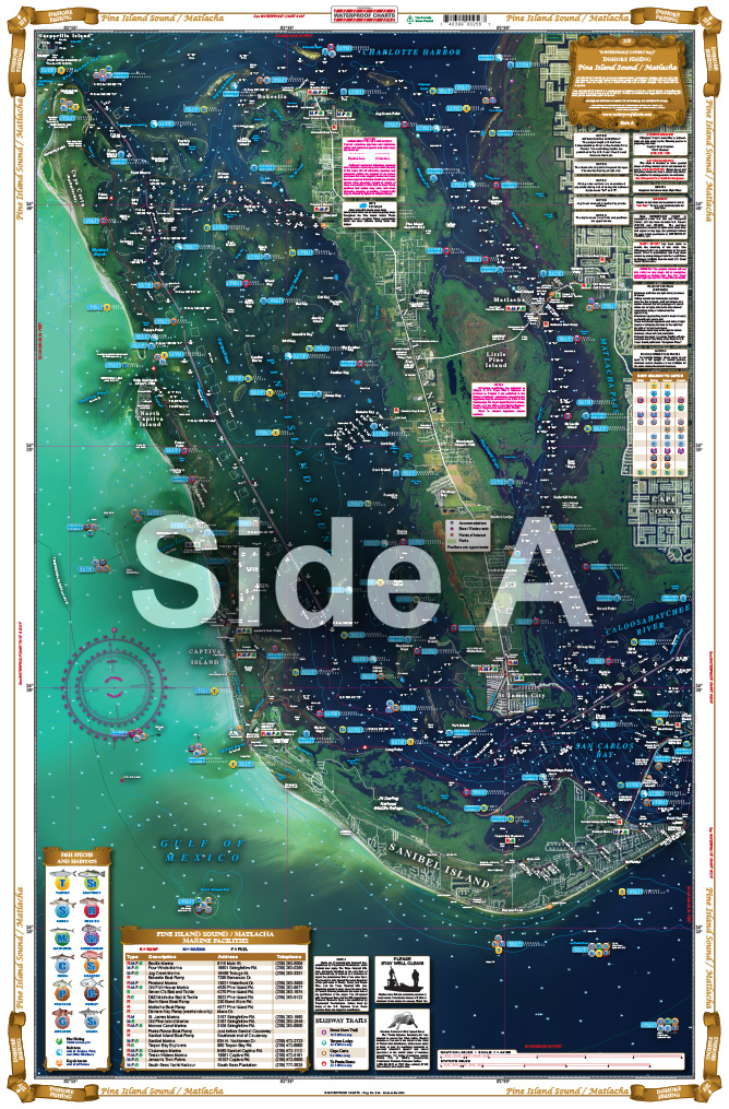
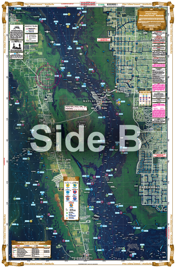
Covering the area from Sanibel Island up to the Northern tip of Pine Island, with a blow up of Matlacha Pass from Sword Point to Bokelia. This special chart details all the major grass flats and pinpoints dozens of specific areas for the major species caught in the area: Trout, Redfish, Snook, Tarpon, and Pompano. There is a handy Marine facilities guide included, giving locations of different Marinas, Boat Ramps & Waterfront Restaurants, all shown on the chart.
THIS IS A FOLDED CHART.
The Area Covered
*NEW SATELLITE VIEW* Covering the area from Sanibel Island up to the Northern tip of Pine Island, with a blow up of Matlacha Pass from Sword Point to Bokelia. This special chart details all the major grass flats and pinpoints dozens of specific areas for the major species caught in the area: Trout, Redfish, Snook, Tarpon, and Pompano. There is a handy Marine facilities guide included, giving locations of different Marinas, Boat Ramps & Waterfront Restaurants, all shown on the chart. If you are coming to fish Pine Island Sound, this is a must have chart! Fishing has never been easier than with this Pine Island Sound and Matlacha fishing chart. This navigation chart covers the area from Sanibel Island up to the Northern tip of Pine Island, with a blow up of Matlacha Pass from Sword Point to Bokelia. This special nautical map details all the major grass flats and pinpoints dozens of specific areas for the major species caught in the area: Trout, Redfish, Snook, Tarpon, and Pompano. There is a handy marine facilities guide which provides locations of different marinas, boat ramps & waterfront restaurants, all shown on the chart. If you are coming to fish Pine Island Sound, this is a must have fishing chart! You will want to frame this navigation map and display it in your home or office. Information from 2 NOAA charts: 11426, 11427. Nautical chart is 25" X 38". WGS84 - World Mercator Datum.
Additional information
| Weight | .167 oz |
|---|---|
| Dimensions | 24 × 36 in |