Savannah to St. Catherine’s Sound Inshore Fishing Chart 97F
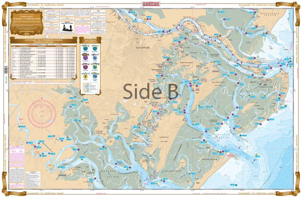
The Area Covered
$32.95
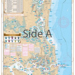
This chart shows inshore coverage up the Medway River, North to Newport River, and detailed coverage of Tybee Island. Details of all backwater creeks and marsh areas for the species caught in that area: Redfish, Trout, Sharks, Flounder, Tarpon, among others. This chart also includes a complete list of all of the boat ramps and info from 3 NOAA charts: #11507, #11509, & #11511.
THIS IS A FOLDED CHART. CAN BE SHIPPED ROLLED UPON REQUEST.
The Area Covered
This chart shows inshore coverage up the Medway River, North to Newport River, and detailed coverage of Tybee Island. Details of all backwater creeks and marsh areas for the species caught in that area: Redfish, Trout, Sharks, Flounder, Tarpon, among others. This chart also includes a complete list of all of the boat ramps and info from 3 NOAA charts: #11507, #11509, & #11511. If you are going to fish anywhere in the Savannah area, you will want this chart. This is the Georgia fishing chart to have if you frequent this area. Details are included for all backwater creeks and marsh areas for the species caught in that area: Redfish, Trout, Sharks, Flounder, Tarpon, among others. We have spoken with fishing charter captains to obtain these secret spots for our fishing charts. This navigation chart shows inshore coverage up the Medway River, North to Newport River, and detailed coverage of Tybee Island. This marine map also includes a complete list of all of the boat ramps. If you are going to fish anywhere in the Savannah area, you will want this fishing chart. Information from 3 NOAA charts: #11507, #11509, & #11511. Nautical Chart is 25" X 38". WGS84 - World Mercator Datum.
Additional information
| Dimensions | 24 × 36 in |
|---|