Biscayne Bay to Florida Bay Inshore Fishing Chart 33F
The Area Covered
$32.95
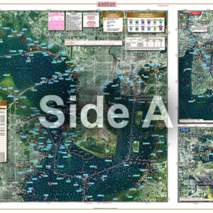
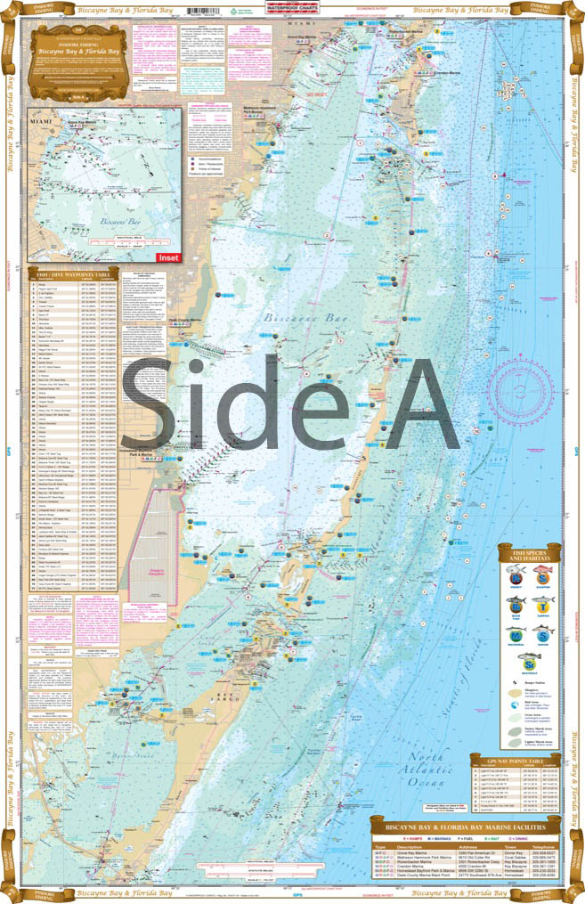
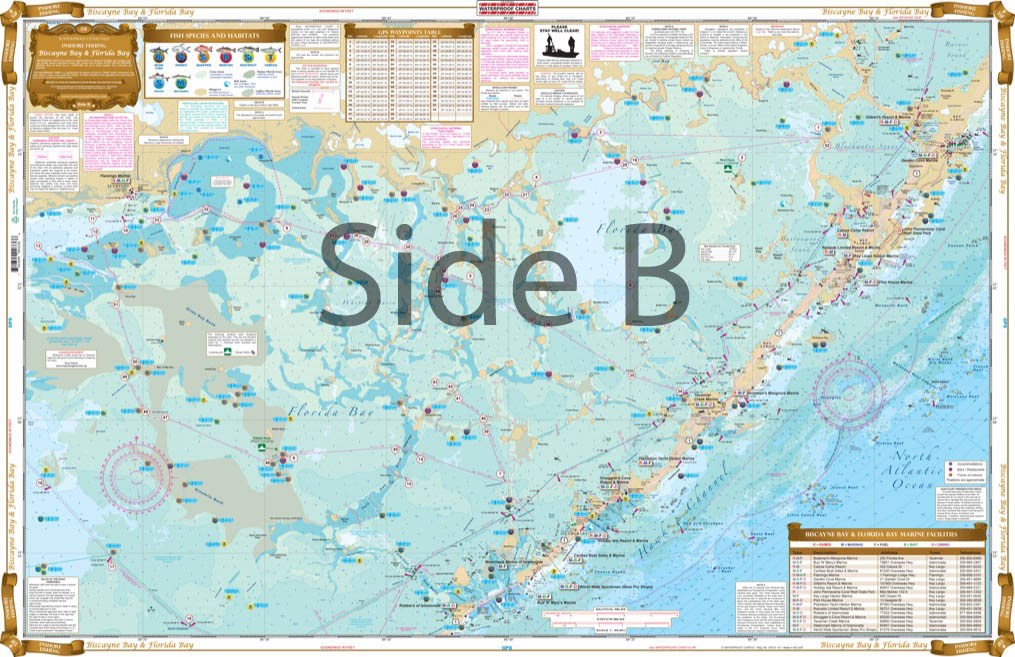
This is the latest in our new series of Inshore Fishing Charts. If you are in search of Bonefish, Permit, Snook, Redfish, Trout, or Tarpon, you are going to want to have this chart. This Large Print Chart has all of Biscayne Bay on one side with Florida Bay on the reverse side.
THIS IS A FOLDED CHART. CAN BE SHIPPED ROLLED UPON REQUEST.
The Area Covered
This is the latest in our new series of Inshore Fishing Charts. If you are in search of Bonefish, Permit, Snook, Redfish, Trout, or Tarpon, you are going to want to have this chart. This Large Print Chart has all of Biscayne Bay on one side with Florida Bay on the reverse side. As well as all of the major grass flats, we have pinpointed dozens of specific areas for the major species caught in this area. We have also included locations of boat ramps, bait stores ,and even popular waterfront dining spots. If you are planning a fishing trip to the Miami area or Florida Bay, this is a must have chart. This Biscayne Bay fishing chart will look amazing when framed and displayed in your home or office. This is the latest in our new series of Inshore Fishing Charts. If you are in search of Bonefish, Permit, Snook, Redfish, Trout, or Tarpon, you are going to want to have this navigation chart. This large print nautical map has all of Biscayne Bay on one side with Florida Bay on the reverse side. As well as all of the major grass flats, we have pinpointed dozens of specific areas for the major species caught in this area. We have also included locations of boat ramps, bait stores ,and even popular waterfront dining spots. If you are planning a fishing trip to the Miami area or Florida Bay, this is a must have marine map. Nautical Chart is 25" X 38". WGS84 - World Mercator Datum.
Additional information
| Dimensions | 24 × 36 in |
|---|