South Florida Maxi Navigation Chart 35
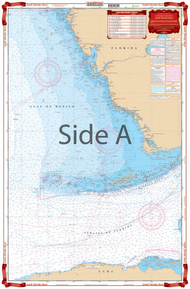
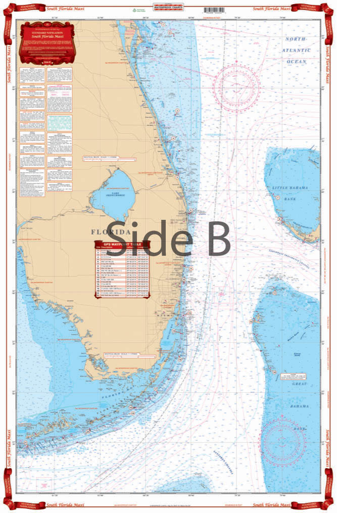
The Area Covered
$32.95
All of South Florida on a single sheet! Southeast Florida from Cape Canaveral to Key West and out to the West Bahamas on one side. Southwest Florida from Tampa Bay south to the Dry Tortugas and Cuba on the reverse side. An excellent chart for planning a trip. 14 plotted and indexed GPS Waypoints on the west side and 22 more Waypoints plotted directly on the east side. Large Print City Names make it easy to find an area.
The Area Covered
All of South Florida on a single sheet! Southeast Florida from Cape Canaveral to Key West and out to the West Bahamas on one side. Southwest Florida from Tampa Bay south to the Dry Tortugas and Cuba on the reverse side. An excellent chart for planning a trip. 14 plotted and indexed GPS Waypoints on the west side and 22 more Waypoints plotted directly on the east side. Large Print City Names make it easy to find an area. All of South Florida on a single sheet! This South Florida map runs from Southeast Florida from Cape Canaveral to Key West and out to the West Bahamas on one side. Southwest Florida from Tampa Bay south to the Dry Tortugas and Cuba on the reverse side. An excellent navigation chart for planning a trip, whether it's a day trip or week long journey. There are 14 plotted and indexed GPS Waypoints on the west side and 22 more Waypoints plotted directly on the east side. Large print city names make it easy to find any area. This navigation map also makes for the perfect framed piece of art for you home or to give to a friend. Information from 2 NOAA Charts: #11460 and #11420. Nautical Chart is 25" X 38". WGS84 - World Mercator Datum.
Additional information
| Dimensions | 24 × 36 in |
|---|