Thousand Island Lake Fishing Chart 78F
$32.95
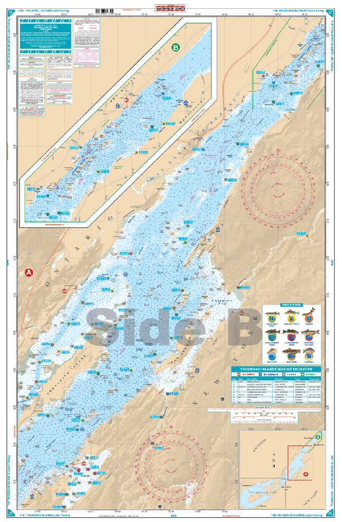
This LARGE PRINT Chart details all of the Major Fishing Areas and pinpoints dozens of specific areas for the major species caught in the area (Large and Smallmouth Bass, Yellow Perch, Walleye, Muskie, Northern Pike, Channel Catfish, Muskie, Bullhead, and Sunfish). Many areas have GPS positions.
THIS IS A FOLDED CHART.
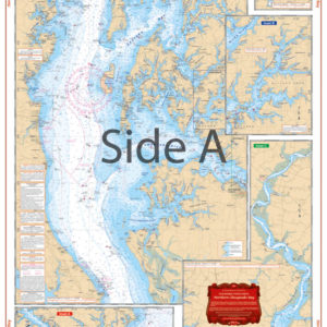
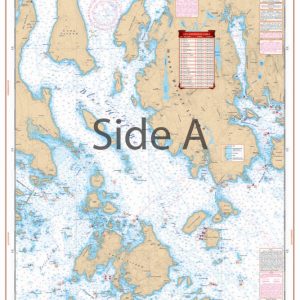
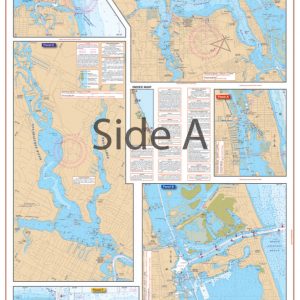
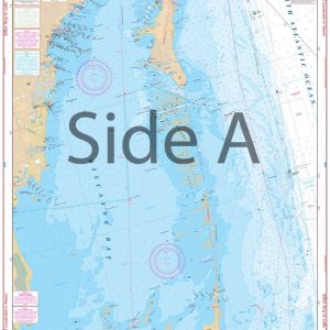
This LARGE PRINT Chart details all of the Major Fishing Areas and pinpoints dozens of specific areas for the major species caught in the area (Large and Smallmouth Bass, Yellow Perch, Walleye, Muskie, Northern Pike, Channel Catfish, Muskie, Bullhead, and Sunfish). Many areas have GPS positions. Marsh areas are also identified. Marinas are listed as well as popular Boat Ramps. Starting at Wolfe and Howe Islands, coverage is east to and including Brockville & Morristown. Information from 3 NOAA Charts: #14772, #14774 & #14773. This is one chart to have if you want to catch fish in this area! Nobody has fishing charts with as much detail as Waterproof Charts. This large print Thousand Islands map details all of the major fishing areas and pinpoints dozens of specific areas for the major species caught in the area (Large and Smallmouth Bass, Yellow Perch, Walleye, Muskie, Northern Pike, Channel Catfish, Muskie, Bullhead, and Sunfish). Many areas have GPS positions that can be easily input into a GPS unit. Marsh areas are also identified. Marinas are listed as well as popular boat ramps to help you get into and out of the water with ease. Starting at Wolfe and Howe Islands, coverage is east to and including Brockville & Morristown. This is one marine map to have if you want to catch fish in this area! Get this nicely illustrated navigation map framed to display in your home or office. Information from 3 NOAA Charts: #14772, #14774 & #14773. Nautical Chart is 25" X 38". WGS84 - World Mercator Datum.
Additional information
| Dimensions | 24 × 36 in |
|---|