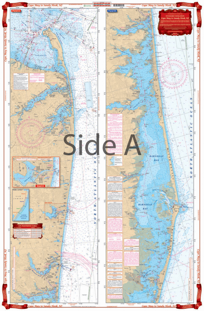
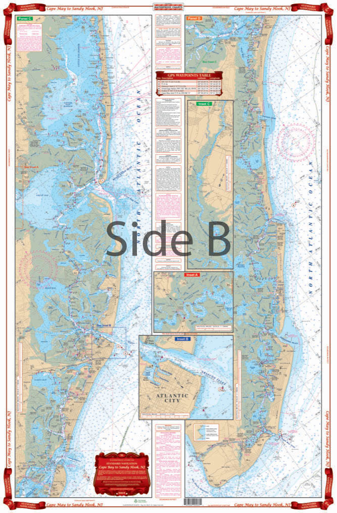
Cape May to Sandy Hook NJ Navigation Chart 56
The Area Covered
$32.95
Complete inside coverage for the New Jersey Shore from Cape May and the Cape May Canal north through Avalon and Ocean City, including Atlantic City, through Great Bay and Little Egg Harbor on the south side. The north panel covers all of Barnegat Bay and Toms River, through the Point Pleasant canal and the Manasquan River. Also covers the Shark River, the Shrewsbury River, the Navesink River and Red Bank and Sandy Hook Bay and Atlantic Highlands. Details are provided for the Shark River, Manasquan Inlet, and Atlantic City. A colored key on each side and large print place names make areas very easy to find.
The Area Covered
Complete inside coverage for the New Jersey Shore from Cape May and the Cape May Canal north through Avalon and Ocean City, including Atlantic City, through Great Bay and Little Egg Harbor on the south side. The north panel covers all of Barnegat Bay and Toms River, through the Point Pleasant canal and the Manasquan River. Also covers the Shark River, the Shrewsbury River, the Navesink River and Red Bank and Sandy Hook Bay and Atlantic Highlands. Details are provided for the Shark River, Manasquan Inlet, and Atlantic City. A colored key on each side and large print place names make areas very easy to find. A total of 14 GPS WAYPOINTS are pre-plotted. Boating and fishing the Jersey Shore NJ has now gotten easier! Our navigation chart provides complete inside coverage for the New Jersey Shore from Cape May and the Cape May Canal north through Avalon and Ocean City, including Atlantic City, through Great Bay and Little Egg Harbor on the south side. The north panel covers all of Barnegat Bay and Toms River, through the Point Pleasant canal and the Manasquan River. This navigation map also covers the Shark River, the Shrewsbury River, the Navesink River and Red Bank and Sandy Hook Bay and Atlantic Highlands. Details are provided for the Shark River, Manasquan Inlet, and Atlantic City. A colored key on each side and large print place names make areas very easy to find. A total of 14 GPS waypoints are pre-plotted. Put this nautical map in a handsome wooden frame and display it in your home or office, or even give it as a gift. Information from 2 NOAA charts; #12324 & #12316. Nautical Chart is 25" X 38". WGS84 - World Mercator Datum.
Additional information
| Dimensions | 24 × 36 in |
|---|