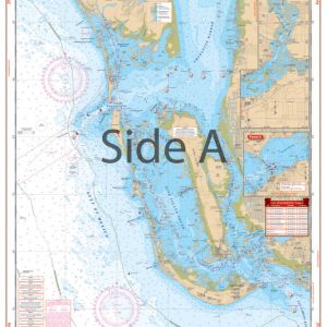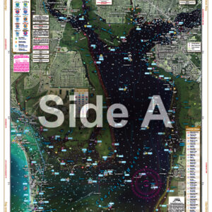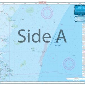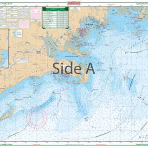

Clearwater Beach to Egmont Key Large Print Navigation Chart 31E
The Area Covered
$32.95
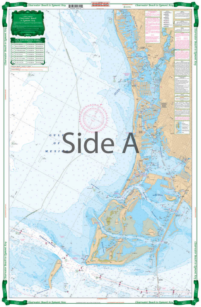
Shows detailed Intracoastal Waterways area from Egmont Key to Sunshine Skyway and North to Clearwater Harbor and Honeymoon Island. Large Print Place Names make areas and inlets easy to find. A total of 15 GPS Waypoints. Covers area From 3 to 6 Miles Offshore as well. You may regret having bought your fancy GPS unit, but you’ll never regret this Clearwater nautical chart. This chart shows detailed intracoastal waterways area from Egmont Key to Sunshine Skyway and North to Clearwater Harbor and Honeymoon Island.
The Area Covered
Shows detailed Intracoastal Waterways area from Egmont Key to Sunshine Skyway and North to Clearwater Harbor and Honeymoon Island. Large Print Place Names make areas and inlets easy to find. A total of 15 GPS Waypoints. Covers area From 3 to 6 Miles Offshore as well. You may regret having bought your fancy GPS unit, but you'll never regret this Clearwater nautical chart. This chart shows detailed intracoastal waterways area from Egmont Key to Sunshine Skyway and North to Clearwater Harbor and Honeymoon Island. Large print place names make areas and inlets easy to find. A total of 15 GPS waypoints will guide you towards places of interest in the area. Covers area from 3 to 6 miles offshore as well. Pick up another navigation map to have framed so you can proudly display it on your office or home wall. Information from NOAA Charts #11411. Nautical chart is 25" X 38". WGS84 - World Mercator Datum.
Additional information
| Dimensions | 24 × 36 in |
|---|