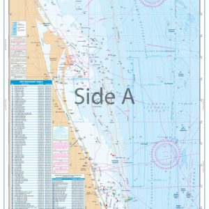
Estero Bay Inshore Fishing Chart 221F
The Area Covered
$32.95
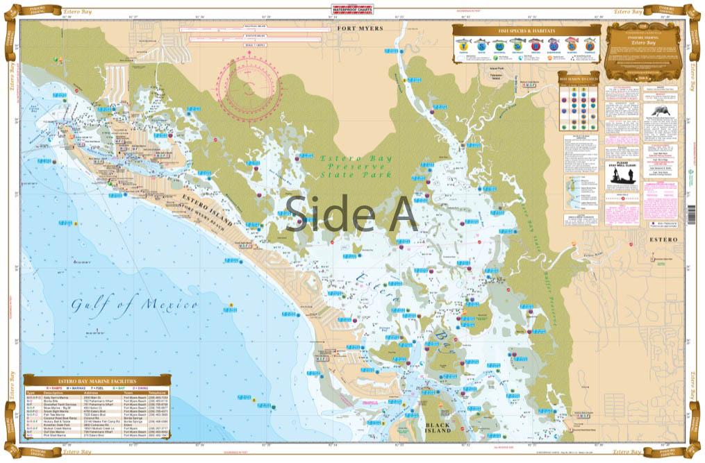
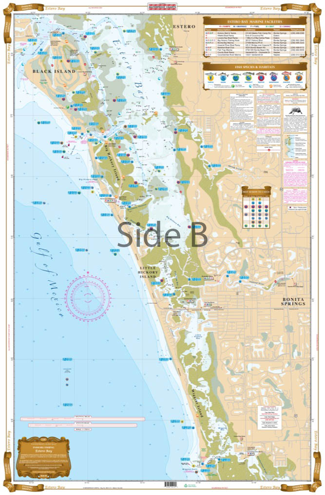
Coverage is from Fort Myers Beach south to Wiggins Pass including Wiggins Bay. This LARGE PRINT chart details all the major Grass Flats areas and pinpoints dozens of specific areas for the major species caught in the area – Snook, Redfish, Trout, Tarpon, Pompano, and Shark, as well as the popular “go to” bait locations.
THIS IS A FOLDED CHART.
The Area Covered
Coverage is from Fort Myers Beach south to Wiggins Pass including Wiggins Bay. This LARGE PRINT chart details all the major Grass Flats areas and pinpoints dozens of specific areas for the major species caught in the area - Snook, Redfish, Trout, Tarpon, Pompano, and Shark, as well as the popular "go to" bait locations. Also included is the "Best Season to Catch Fish" chart. You also get all of the Boat Ramps, Kayak Access, Fishing Piers, Waterfront Restaurants, Marinas and Fuel Locations shown on this chart. If you are fishing Estero you need this chart! This Estero Bay fishing chart needs to be in your tackle box. Coverage runs from Fort Myers Beach south to Wiggins Pass including Wiggins Bay. This large print fishing chart details all the major grass flats areas and pinpoints dozens of specific areas for the major species caught in the area - Snook, Redfish, Trout, Tarpon, Pompano, and Shark, as well as the popular "go to" bait locations. Also included is the "Best Season to Catch Fish" chart. You also get all of the boat ramps, kayak access, fishing piers, waterfront restaurants, marinas and fuel locations shown on this chart. If you are fishing Estero Bay you need this navigation chart! You will also want to frame this marine map to hang in your home or office. Nautical Chart is 25" X 38". WGS84 - World Mercator Datum.
Additional information
| Dimensions | 24 × 36 in |
|---|