Galveston Bay Navigation Chart 111
The Area Covered
$32.95
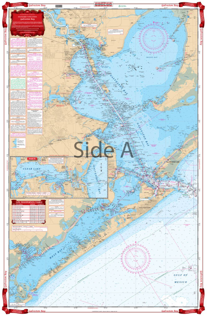
A terrific combination of charts for a great view of the entire bay. Coverage from Baytown south to Galveston and west to San Luis Pass. This brightly colored edition has latitude and longitude lines that makes it is easy to use with your GPS. Detailed Inset for Clear Lake and coverage of all of West Bay and all of Galveston Island.
The Area Covered
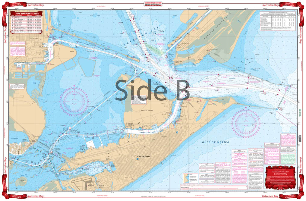
A terrific combination of charts for a great view of the entire bay. Coverage from Baytown south to Galveston and west to San Luis Pass. This brightly colored edition has latitude and longitude lines that makes it is easy to use with your GPS. Detailed Inset for Clear Lake and coverage of all of West Bay and all of Galveston Island. This chart includes a table of plotted GPS coordinates for entrance buoys and important markers. The reverse side is a blow up which covers the Galveston and Pelican Island area with a detailed view of the ICW and of Offatts Bayou and the Texas City Dike area. GPS Coordinates on both sides! This is a terrific combination of NOAA charts for a great view of the entire Galveston Bay. Coverage runs from Baytown south to Galveston and west to San Luis Pass. This brightly colored edition has latitude and longitude lines that makes it is easy to use with your GPS. Detailed inset for Clear Lake and coverage of all of West Bay and all of Galveston Island. This navigation chart includes a table of plotted GPS coordinates for entrance buoys and important markers. The reverse side of this marine map is a blow up which covers the Galveston Bay and Pelican Island area with a detailed view of the Intracoastal Waterway and of Offatts Bayou and the Texas City Dike area. GPS coordinates are added to both sides! This is a Galveston Bay map you will want to get framed. Information from 3 NOAA Charts: #11322, #11324, and #11326. Nautical Chart is 25" X 38". WGS84 - World Mercator Datum.
Additional information
| Dimensions | 24 × 36 in |
|---|