
Georgian Bay to Sault Ste Marie Navigation Chart 177
$32.95
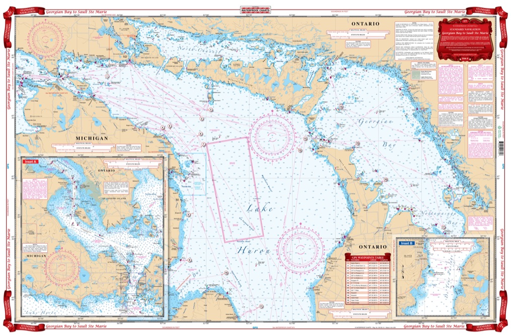
Side A includes the Straits of Macinac east to Lake Huron, north to St. Mary’s river and the North Channel, south to Saginaw Bay, and further east to the Georgian and Nottawasaga Bays. A larger scale Inset of the De Tour Passage provides detail to begin your trip up the St. Mary’s river and points north. Side B begins at Whitfish Bay and continues through Sault Ste Marie (with Inset detail) along the St. Mary’s River to St. Joseph Island at Munuscong Lake where it joins Side A.
Side A includes the Straits of Macinac east to Lake Huron, north to St. Mary's river and the North Channel, south to Saginaw Bay, and further east to the Georgian and Nottawasaga Bays. A larger scale Inset of the De Tour Passage provides detail to begin your trip up the St. Mary's river and points north. Side B begins at Whitfish Bay and continues through Sault Ste Marie (with Inset detail) along the St. Mary's River to St. Joseph Island at Munuscong Lake where it joins Side A. Exceptional colors make the chart easy to use. Reproductions of portions of NOAA charts #14860, #14882, #14883, and #14884. Plotted waypoints are included to help you set your course(s). Plot your journey from Georgian Bay through Lake Huron up to Sault Ste Marie with ease using this marine map. Side A includes the Straits of Mackinac east to Lake Huron, north to St. Mary's river and the North Channel, south to Saginaw Bay, and further east to the Georgian and Nottawasaga Bays. A larger scale Inset of the De Tour Passage provides detail to begin your trip up the St. Mary's river and points north. Side B begins at Whitefish Bay and continues through Sault Ste Marie (with Inset detail) along the St. Mary's River to St. Joseph Island at Munuscong Lake where it joins Side A. Plotted waypoints are included to help you set your course. Exceptional colors make the navigation chart easy to use and excellent for framing. Reproductions of portions of NOAA charts #14860, #14882, #14883, and #14884. Nautical Chart is 25" X 38". WGS84 - World Mercator Datum.
Additional information
| Dimensions | 24 × 36 in |
|---|