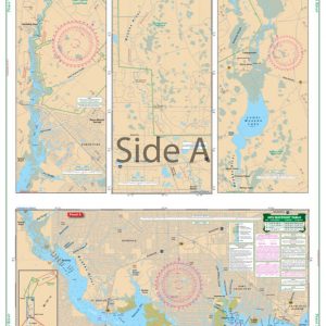
Great South Bay Large Print Navigation Chart 6E
The Area Covered
$32.95
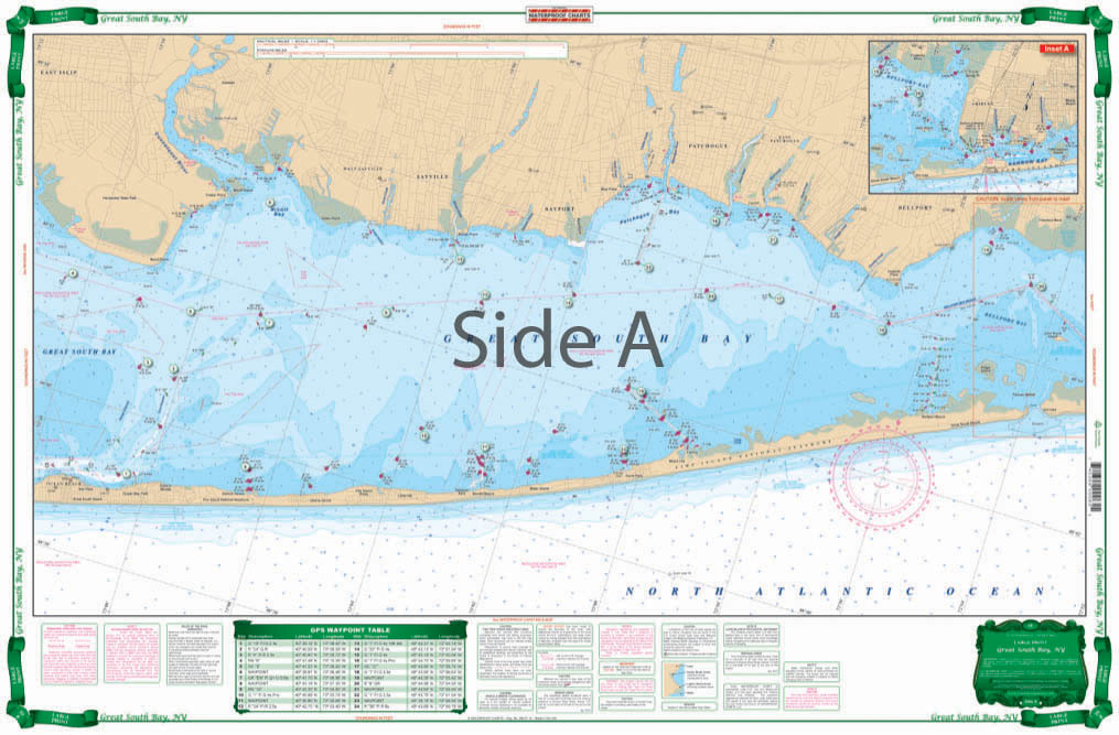
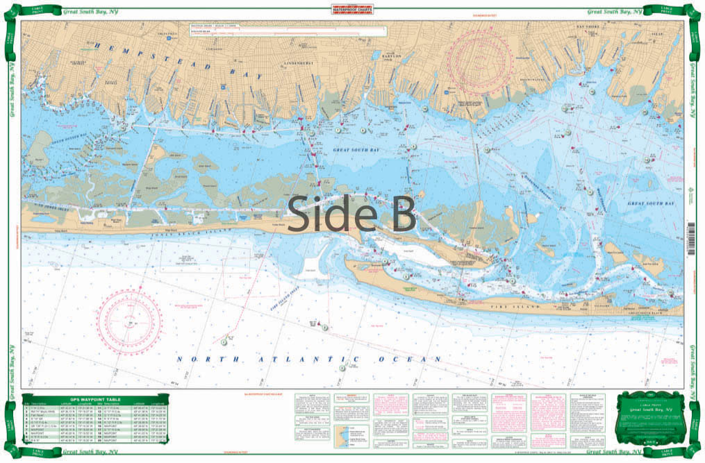
Expanded coverage from South Oyster Bay, east through Great South Bay to Bellport Bay. Large print and large place names are easy to read. This chart includes 28 GPS Waypoints. Kayakers, paddleboarders, fishermen, and boaters, you need this Great South Bay marine map!
The Area Covered
Expanded coverage from South Oyster Bay, east through Great South Bay to Bellport Bay. Large print and large place names are easy to read. This chart includes 28 GPS Waypoints. Kayakers, paddleboarders, fishermen, and boaters, you need this Great South Bay marine map! You will now enjoy planning your outings using this highly detailed chart. It offers expanded coverage from South Oyster Bay, east through Great South Bay to Bellport Bay. Large print and large place names are easy to read. This navigation chart includes 28 GPS Waypoints to help you find points of interest in the area. This nautical map is excellent to give as a gift, or have framed to hang on an office or home wall. Information from NOAA chart #12352. Nautical Chart is 25" X 38". WGS84 - World Mercator Datum.
Additional information
| Weight | 0.2 oz |
|---|---|
| Dimensions | 24 × 36 in |