Jacksonville and St. Johns River Navigation Chart 37
The Area Covered
$32.95
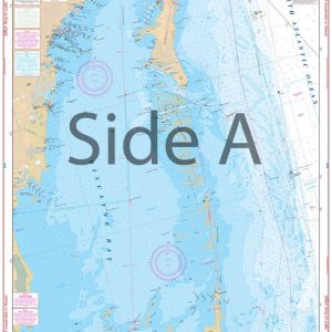
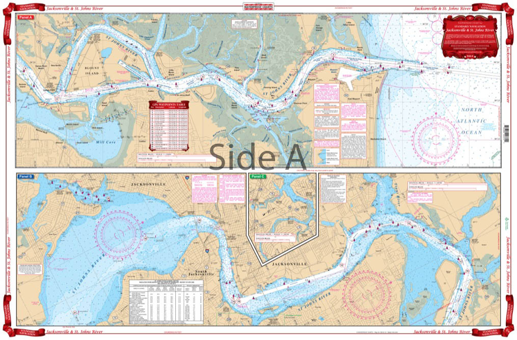
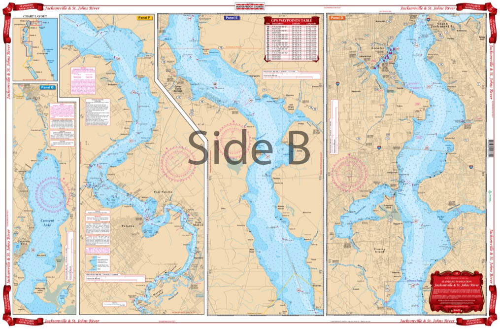
Starting at the Atlantic Ocean, this chart covers up the St. Johns River to city of Jacksonville, continuing upstream through Green Cove Springs, Palatka, covering Murphy and Dunn Creeks and includes all of Crescent Lake.
The Area Covered
Starting at the Atlantic Ocean, this chart covers up the St. Johns River to city of Jacksonville, continuing upstream through Green Cove Springs, Palatka, covering Murphy and Dunn Creeks and includes all of Crescent Lake. Also covered are the Arlington River and the Ortega River areas in Jacksonville and Doctors Lake. Don't step on your boat without this navigation map. You will wonder what you ever did without it! Even if you are brand new to the area, you will seem like an expert navigator with this St Johns River map. Starting at the Atlantic Ocean, this navigation chart covers up the St Johns River to city of Jacksonville, continuing upstream through Green Cove Springs, Palatka, covering Murphy and Dunn Creeks and includes all of Crescent Lake. Also covered are the Arlington River and the Ortega River areas in Jacksonville and Doctors Lake. A table of GPS waypoints helps point out important areas, which you can easily plug into a GPS unit. Don't add just one of these marine maps to your cart, get two! One will be kept on the boat, another will be framed and put up on the wall at your office or home. Information from 2 NOAA Charts: #11491 & #11492. Nautical Chart is 25" X 38". WGS84 - World Mercator Datum.
Additional information
| Dimensions | 24 × 36 in |
|---|