Jacksonville to Brunswick Inshore Fishing Chart 36F
The Area Covered
$32.95
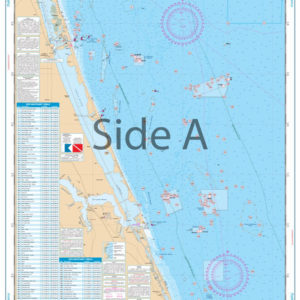
INSHORE FISHING CHART. Complete coverage of St. Johns River from Jacksonville to the Atlantic then north to Brunswick. Complete coverage of Amelia, Cumberland, and Jekyll Islands including excellent detail of St. Andrew Sound and St. Simon Sound.
THIS IS A FOLDED CHART. CAN BE SHIPPED ROLLED UPON REQUEST.
The Area Covered
INSHORE FISHING CHART. Complete coverage of St. Johns River from Jacksonville to the Atlantic then north to Brunswick. Complete coverage of Amelia, Cumberland, and Jekyll Islands including excellent detail of St. Andrew Sound and St. Simon Sound. This is THE inshore fishing chart for the Jacksonville area. Complete coverage runs from St. Johns River from Jacksonville to the Atlantic then north to Brunswick. Complete coverage of Amelia, Cumberland, and Jekyll Islands including excellent detail of St. Andrew Sound and St. Simon Sound. The navigation chart makes it easy to decipher water depths based on color. We have also provided a chart of the popular local fish species as well as GPS waypoints for areas of interest. If you're in the Jacksonville fishing or boating scene, you'll need to frame this chart and display it on your wall at home or your office. Information from NOAA charts: #11488, #11489. Nautical Chart is 25" X 38". WGS84 - World Mercator Datum.
Additional information
| Dimensions | 24 × 36 in |
|---|