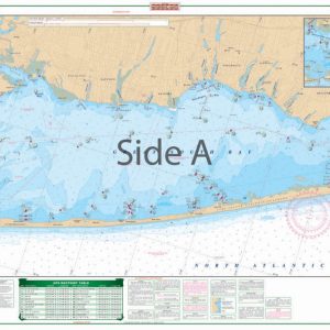
Barnegat Bay Large Print Navigation Chart 56E
The Area Covered
$32.95
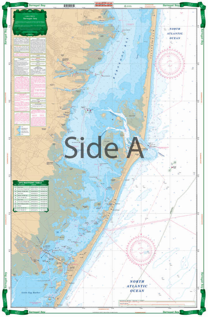
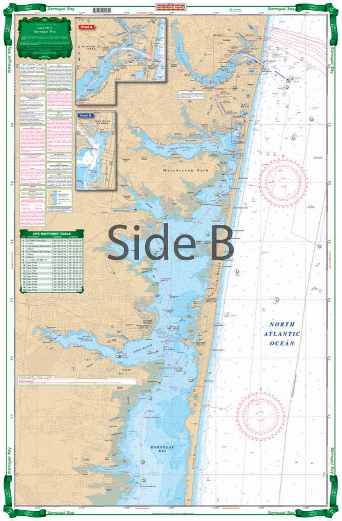
This large print chart covers the Manasquan Inlet Bay Head, the Metedconk River, and the Toms River areas. Provides coastal coverage up to 4 miles offshore. This chart includes 31 sets of plotted GPS coordinates on the chart. Don’t leave the dock without this Barnegat Bay nautical map. This large print navigation chart covers the Manasquan Inlet Bay Head, the Metedeconk River, and the Toms River areas.
The Area Covered
This large print chart covers the Manasquan Inlet Bay Head, the Metedconk River, and the Toms River areas. Provides coastal coverage up to 4 miles offshore. This chart includes 31 sets of plotted GPS coordinates on the chart. Don't leave the dock without this Barnegat Bay nautical map. This large print navigation chart covers the Manasquan Inlet Bay Head, the Metedeconk River, and the Toms River areas. This chart provides coastal coverage up to 4 miles offshore. You will find 31 sets of plotted GPS coordinates on the chart for your convenience. Plug them into your GPS and you're ready to go! We recommend framing this navigation map and displaying it in your home or office. Information from NOAA chart #12324. Nautical Chart is 25" X 38". WGS84 - World Mercator Datum.
Additional information
| Dimensions | 24 × 36 in |
|---|