Lower St. Johns River Fishing Chart 138F
$32.95
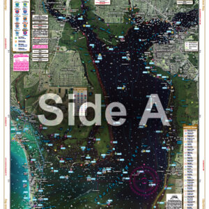
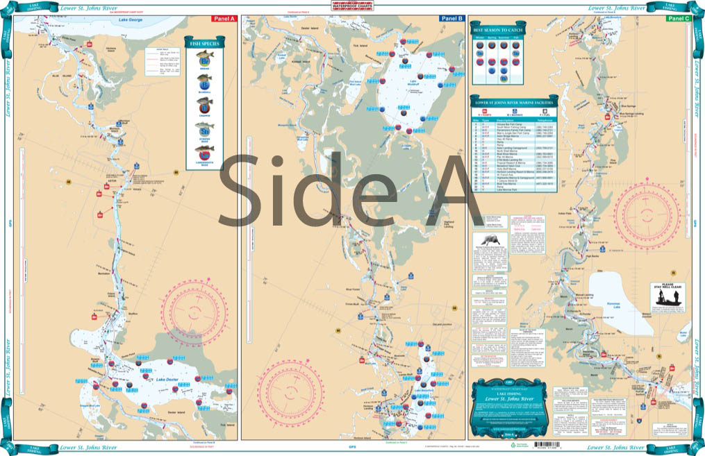
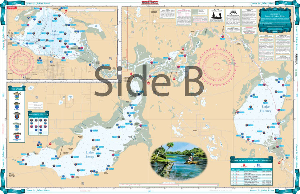
Covering the area from Lake Harney to the bottom of Lake George. This chart details all the major grass flats, marshes, and kayak trails. The chart pinpoints dozens of specific areas for the major species caught and best seasons to catch: Bluegill, Largemouth Bass, Channel Catfish, Crappie, Bream, and Striped Bass.
THIS IS A FOLDED CHART. CAN BE SHIPPED ROLLED UPON REQUEST.
Covering the area from Lake Harney to the bottom of Lake George. This chart details all the major grass flats, marshes, and kayak trails. The chart pinpoints dozens of specific areas for the major species caught and best seasons to catch: Bluegill, Largemouth Bass, Channel Catfish, Crappie, Bream, and Striped Bass. There is a handy marine facilities guide included, with locations of different boat ramps, all shown on the chart. Grab this vibrantly colored St Johns River fishing chart and start catching more fish! This navigation map covers the area from Lake Harney to the bottom of Lake George. This marine map details all the major grass flats, marshes, and kayak trails. The chart pinpoints dozens of specific areas for the major species caught and best seasons to catch: Bluegill, Largemouth Bass, Channel Catfish, Crappie, Bream, and Striped Bass. There is a handy marine facilities guide included, with locations of different boat ramps, all shown on the navigation chart. The artistic fish rendering and bright colors make this chart perfect for framing or giving as a gift. Nautical Chart is 25" X 38". WGS84 - World Mercator Datum.
You may also like our Upper and Central St. Johns River charts as well.
Additional information
| Dimensions | 24 × 36 in |
|---|