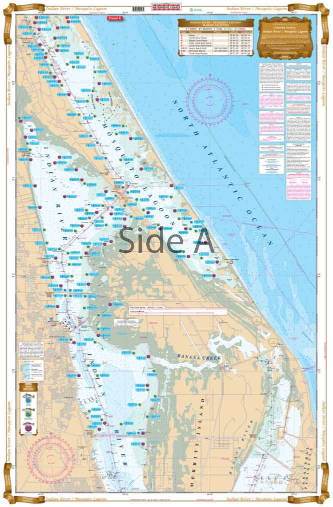
Mosquito Lagoon and Indian River Inshore Fishing Chart 42F
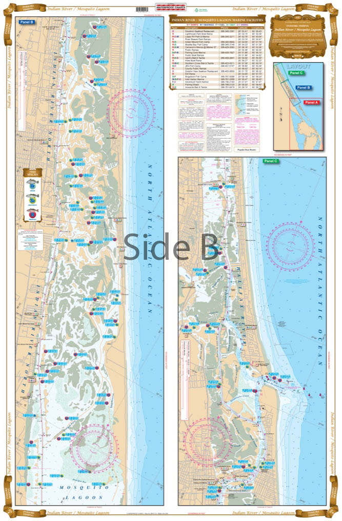
The Area Covered
$32.95
Complete inshore coverage of the Mosquito Lagoon and Indian River area. This chart is unique in that it is large print and includes a blow up of the Mosquito Lagoon. With the assistance and feedback from local fishing guides and tackle shops, we have compiled all of the information you need to fish the area. The chart also shows the new pole and troll areas and the major grass flats. Popular spots highlighted include Whale Tail, Cucumber Island, and others.
The Area Covered
Complete inshore coverage of the Mosquito Lagoon and Indian River area. This chart is unique in that it is large print and includes a blow up of the Mosquito Lagoon. With the assistance and feedback from local fishing guides and tackle shops, we have compiled all of the information you need to fish the area. The chart also shows the new pole and troll areas and the major grass flats. Popular spots highlighted include Whale Tail, Cucumber Island, and others. Dozens of specific areas for Redfish, Trout, and Black Drum are pinpointed. Major boat ramps are shown and listed in an easy to read index. Mosquito Lagoon fishing doesn't get any better than with this fishing chart. Our navigation chart has complete inshore coverage of the Mosquito Lagoon and Indian River area. With the assistance and feedback from local fishing guides and tackle shops, we have compiled all of the information you need to fish this area. The nautical map also shows the new pole and troll areas and the major grass flats. Popular spots include Whale Tail, Cucumber Island, and others. Dozens of specific areas for Redfish, Trout, and Black Drum are pinpointed. Major boat ramps are shown and listed in an easy to read index. Besides all this wealth of information, these navigation charts are handsome enough to be framed and displayed on any home or office wall. Nautical Chart is 25" X 38". WGS84 - World Mercator Datum.
Additional information
| Dimensions | 24 × 36 in |
|---|