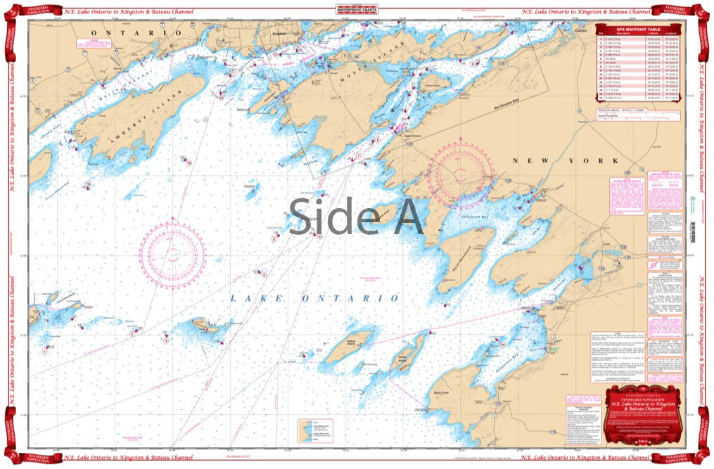
Northeast Lake Ontario Kingston and Bateau Channel Navigation Chart 141
The Area Covered
$32.95
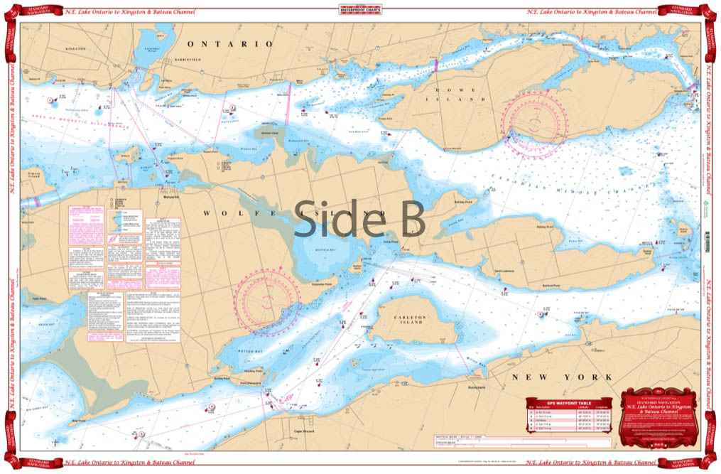
Side one has detailed coverage of the islands and channels between Kingston, Ontario, and Cape Vincent, New York, east to the Wolfe Island Cut. Includes coverage of the Canadian Middle Channel and the Bateau Channel on the north side of Howe Isle. The reverse side covers Kingston and Clayton in a smaller scale, and provides a larger area, including all of Wolfe Island south to Stony Point and Henderson Harbor, and west to False Ducks Islands.
The Area Covered
Side one has detailed coverage of the islands and channels between Kingston, Ontario, and Cape Vincent, New York, east to the Wolfe Island Cut. Includes coverage of the Canadian Middle Channel and the Bateau Channel on the north side of Howe Isle. The reverse side covers Kingston and Clayton in a smaller scale and provides a larger area, including all of Wolfe Island south to Stony Point and Henderson Harbor, and west to False Ducks Islands. Don't go off the dock without this navigation map. Side one has detailed coverage of the islands and channels between Kingston, Ontario, and Cape Vincent, New York, east to the Wolfe Island Cut. Includes coverage of the Canadian Middle Channel and the Bateau Channel on the north side of Howe Isle. The reverse side of this nautical chart covers Kingston and Clayton in a smaller scale and provides a larger area, including all of Wolfe Island south to Stony Point and Henderson Harbor, and west to False Ducks Islands. Information from 3 NOAA charts: #14768, #14767, and #14802. Chart is 25" X 38". WGS84 - World Mercator Datum.
Additional information
| Dimensions | 24 × 36 in |
|---|