
New York Harbor to Block Island Large Print Navigation Chart 2E
The Area Covered
$32.95
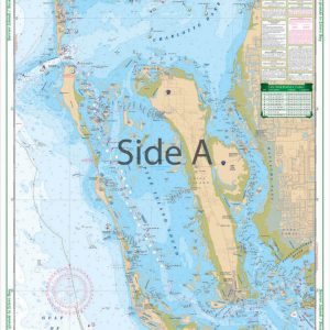
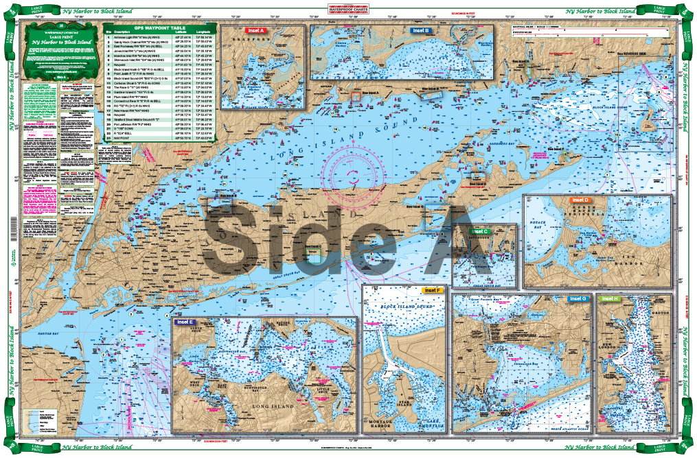
Coverage and scale are available from no other source. Excellent coverage from the North Jersey Shore’s Shark River Inlet, Raritan Bay and New York Harbor east, covering all of Long Island and the Hampton Bays and the entire Connecticut Shore. This chart also covers Long Island Sound, Fishers Island Sound, and Block Island Sound. Latitude and longitude lines make it very easy to use with your GPS. 35 Waypoints are preplotted.
The Area Covered
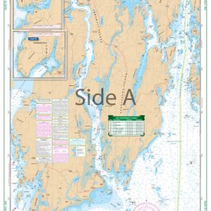
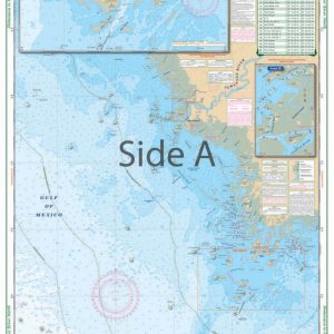
Coverage and scale are available from no other source. Excellent coverage from the North Jersey Shore's Shark River Inlet, Raritan Bay and New York Harbor east, covering all of Long Island and the Hampton Bays and the entire Connecticut Shore. This chart also covers Long Island Sound, Fishers Island Sound, and Block Island Sound. Latitude and longitude lines make it very easy to use with your GPS. 35 Waypoints are preplotted. The reverse side includes complete detailed coverage for Block Island. An excellent chart for planning the seasons boating and for the framting for home or office. Information from 9 different government charts. Don't step off the dock without this navigation chart. Our charts are durable, detailed, and accurate. The artwork and color make this nautical map perfect for framing on your wall or office. Coverage and scale are available from no other source. We've spent tons of time going in depth in this area to get you the best coverage. Excellent detail covers the North Jersey Shore's Shark River Inlet, Raritan Bay and New York Harbor east, covering all of Long Island and the Hampton Bays and the entire Connecticut Shore. The reverse side includes complete detailed coverage for Block Island. This nautical map also covers Long Island Sound, Fishers Island Sound, and Block Island Sound. Latitude and longitude lines make it very easy to use with your GPS. 35 Waypoints are preplotted to help you find points of interest. This is an excellent navigation chart for planning the seasons, boating, and for the framing for home or office. Information from 9 different government charts. Nautical chart is 25" X 38". WGS84 - World Mercator Datum.
Additional information
| Dimensions | 24 × 36 in |
|---|