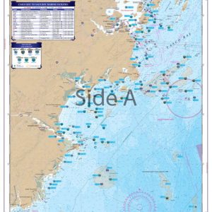
Northern Chesapeake Coastal Fishing Chart 24F
$32.95
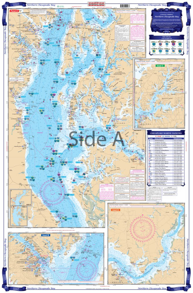
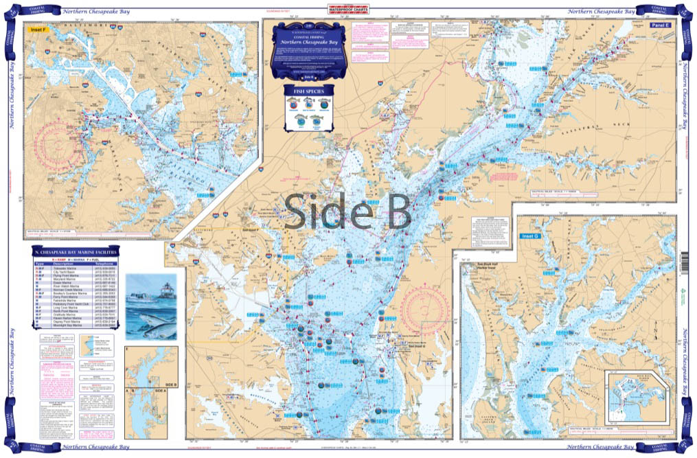
Local Fishing Spots for Blue Fish, Croker, Drum, Flounder, Mackeral, Seatrout, Striped Bass, White Perch, and Weakfish all with GPS Waypoints. Complete coverage from the C&D canal south past Annapolis to the Choptank River and Cove Point. Six Insets provide details for Chester River, Baltimore Harbor, Annapolis, the Tred Avon River, and Choptank River.
Local Fishing Spots for Blue Fish, Croker, Drum, Flounder, Mackeral, Seatrout, Striped Bass, White Perch, and Weakfish all with GPS Waypoints. Complete coverage from the C&D canal south past Annapolis to the Choptank River and Cove Point. Six Insets provide details for Chester River, Baltimore Harbor, Annapolis, the Tred Avon River, and Choptank River. Colored Keys on both sides make it easy to understand. Most Marinas and Boat Ramps are listed. Your Chesapeake Bay fishing trip will now involve more fishing and less looking for honey holes. Local fishing spots for Blue Fish, Croker, Drum, Flounder, Mackeral, Seatrout, Striped Bass, White Perch, and Weakfish all with GPS waypoints. Complete coverage from the C&D canal south past Annapolis to the Choptank River and Cove Point is included in this nautical map. Six insets provide details for Chester River, Baltimore Harbor, Annapolis, the Tred Avon River, and Choptank River. Colored keys on both sides make it easy to understand. Most marinas and boat ramps are listed to help you get in and out of the water. You'll find the vibrant colors make this marine map excellent for framing. Information from 7 different NOAA Charts; #12263, #12266, #12268, #12270, #12278, #12272, and #12273. Nautical Chart is 25" X 38". WGS84 - World Mercator Datum.
Additional information
| Dimensions | 24 × 36 in |
|---|