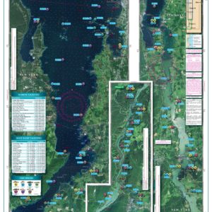
Northern Lake Champlain Navigation Chart 12
The Area Covered
$32.95
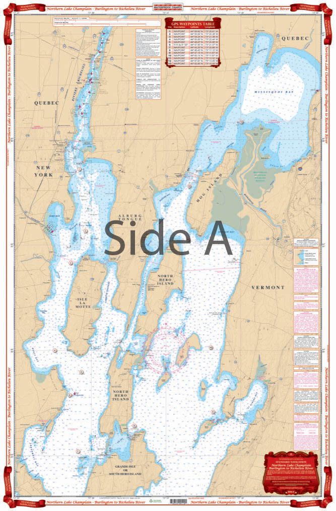
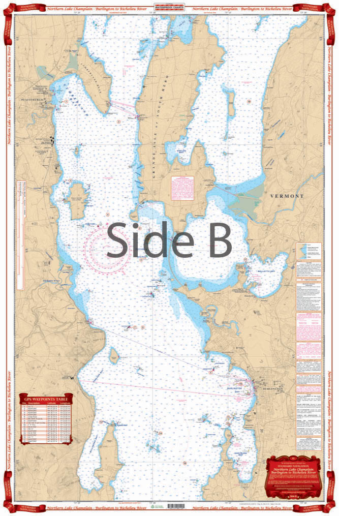
You won’t find a more detailed nautical map than this. Or a more eye-catching one, you will want to frame this and hang it in your home or office. Starting at Willsboro Point and Shelburne Point coverage is north to and including Missisquoi Bay and the Route 202 Bridge on the Richelieu River in Canada. This navigation chart also includes Malletts Bay and all of the Champlain Islands.
The Area Covered
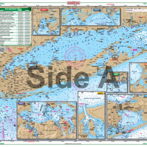
Starting at Willsboro and Shelburne Points coverage is north to and including Missisquoi Bay and the Rt 202 Bridge on the Richelieu River in Canada. Includes Malletts Bay and all of the Champlain Islands. When you're headed out on Lake Champlain, you'll need this marine map. C'mon trust us! You won't find a more detailed nautical map than this. Or a more eye-catching one, you will want to frame this and hang it in your home or office. Starting at Willsboro Point and Shelburne Point coverage is north to and including Missisquoi Bay and the Route 202 Bridge on the Richelieu River in Canada. This navigation chart also includes Malletts Bay and all of the Champlain Islands. This is a great complement to our southern Lake Champlain map #11. Information from 2 NOAA Charts: #14782 & #14781. Nautical Chart is 24" X 36". WGS84 - World Mercator Datum.
Additional information
| Dimensions | 24 × 36 in |
|---|