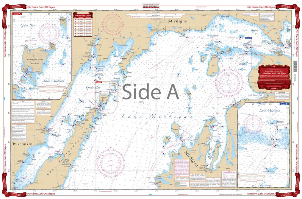
Northern Lake Michigan Navigation Chart 72
The Area Covered
$32.95
Overall coverage of the northern section of the lake from Frankfort, Michigan and Green Bay, Wisconsin, north to the Straits of Makinac. Provides details for the Grays Reef Passage and the Washington Island, Wisconsin area. Covers all of Green Bay and Door County.
The Area Covered
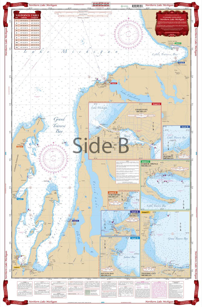
Overall coverage of the northern section of the lake from Frankfort, Michigan and Green Bay, Wisconsin, north to the Straits of Makinac. Provides details for the Grays Reef Passage and the Washington Island, Wisconsin area. Covers all of Green Bay and Door County. The reverse side covers the Grand Traverse and Little Traverse Bay area, with detailed harbor insets for Traverse City, Suttons Bay, Elk Rapids, Northport, Harbor Springs, Petoskey and Charlevoix. This northern Lake Michigan map is the perfect tool for plotting a trip across the lake, or just a quick outing. This nautical map has overall coverage of the northern section of the lake from Frankfort, Michigan and Green Bay, Wisconsin, north to the Straits of Mackinac. It provides details for the Grays Reef Passage and the Washington Island, Wisconsin area. This navigation chart covers all of Green Bay and Door County. The reverse side covers the Grand Traverse and Little Traverse Bay area, with detailed harbor insets for Traverse City, Suttons Bay, Elk Rapids, Northport, Harbor Springs, Petoskey and Charlevoix. This navigation map is a perfect complement to chart #70 covering Chicago and Lake Michigan. Grab two of these nautical charts, one for the boat and another to be framed and displayed at your home or office. Information compiled from 5 NOAA Charts: #14902, #14909, #14911, #14913, and #14942. Nautical Chart is 25" X 38". WGS84 - World Mercator Datum.
Additional information
| Dimensions | 24 × 36 in |
|---|