
Northwest Florida Fishing Offshore Fish and Dive Chart 5F
The Area Covered
$32.95
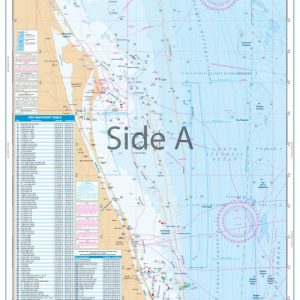
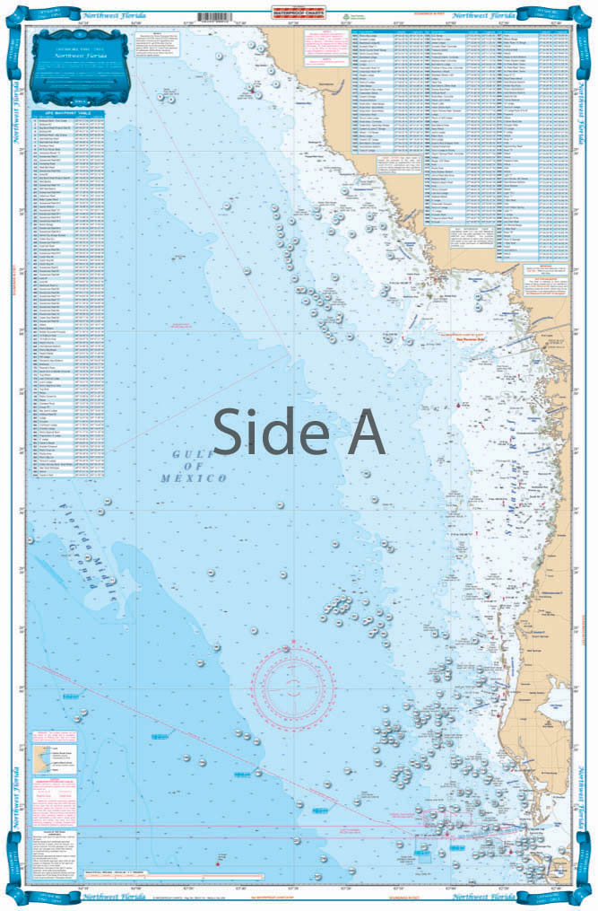
Offshore coverage from Steinhatchee River south to Anna Maria Island and out to the Florida Middle Grounds (100 miles). Coastal Coverage on reverse side from Port Inglis south to Anclote River. 184 Plotted and Indexed GPS Positions with descriptions for Reefs, Wrecks, Ledges and Markers. Enhanced Contour Lines. If you are a Florida fishing enthusiast, this North Florida fishing chart was made for you.
The Area Covered
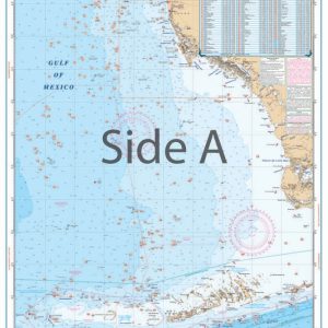
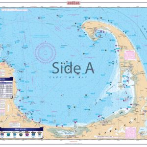
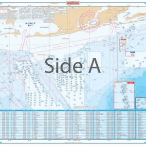
Offshore coverage from Steinhatchee River south to Anna Maria Island and out to the Florida Middle Grounds (100 miles). Coastal Coverage on reverse side from Port Inglis south to Anclote River. 184 Plotted and Indexed GPS Positions with descriptions for Reefs, Wrecks, Ledges and Markers. Enhanced Contour Lines. If you are a Florida fishing enthusiast, this North Florida fishing chart was made for you. You will be able to plan inshore as well as offshore fishing trips for you and your friends. Offshore coverage runs from Steinhatchee River south to Anna Maria Island and out to the Florida Middle Grounds (100 miles). Coastal coverage on reverse side is from Port Inglis south to Anclote River. This navigation map includes 184 Plotted and indexed GPS positions with descriptions for Reefs, Wrecks, Ledges and Markers. Enhanced contour lines have also been included. You will be sure to find the honey holes using this navigation chart. The design and vibrant color of this nautical map make it excellent for framing. Information from 2 NOAA Charts: #11409 & #11400. Nautical Chart is 25" X 38". WGS84 - World Mercator Datum.
Additional information
| Dimensions | 24 × 36 in |
|---|