Saginaw Bay Lake Fishing Chart 74F
$32.95
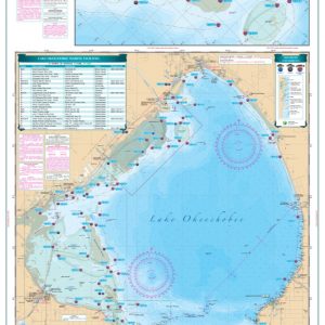
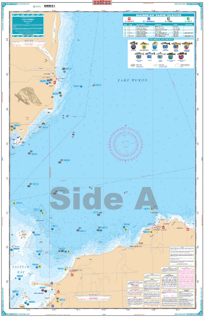
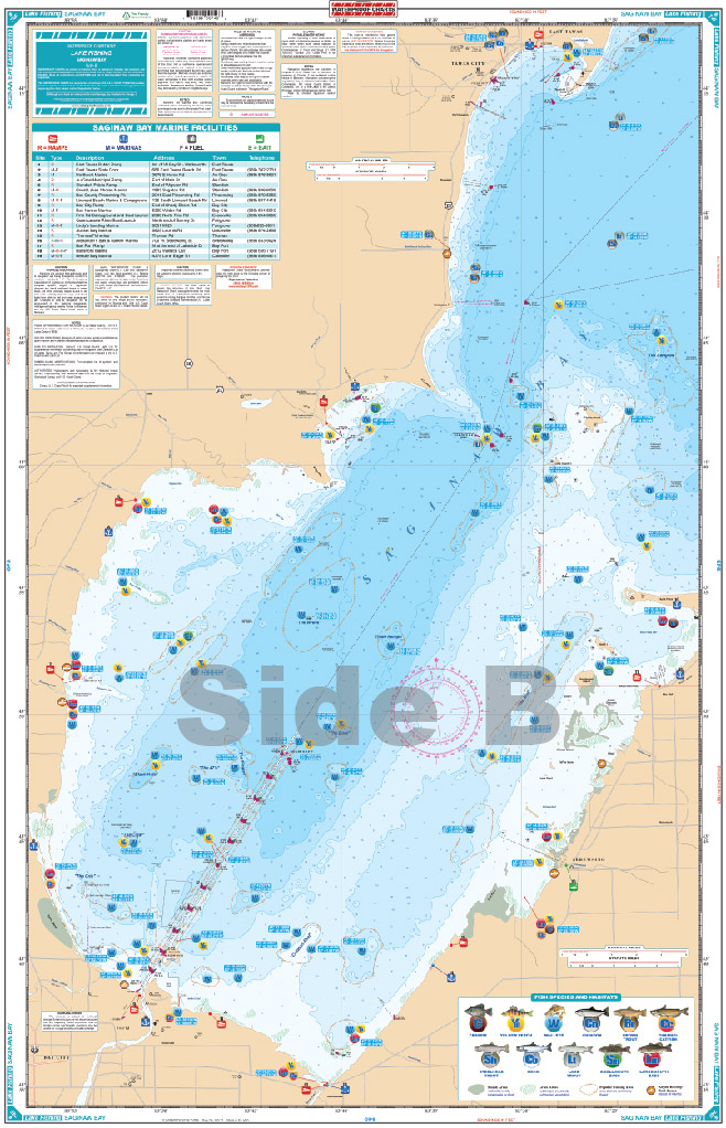
This chart details all the major fishing areas and pinpoints dozens of specific areas for the major species caught in the area: Largemouth Bass, Smallmouth Bass, Yellow Perch, Walleye, Brown Trout, Channel Catfish, Steelhead Trout, Lake Trout, Crappie, Coho, and Chinook.
THIS IS A FOLDED CHART. CAN BE SHIPPED ROLLED UPON REQUEST.
This chart details all the major fishing areas and pinpoints dozens of specific areas for the major species caught in the area: Largemouth Bass, Smallmouth Bass, Yellow Perch, Walleye, Brown Trout, Channel Catfish, Steelhead Trout, Lake Trout, Crappie, Coho, and Chinook. Each area where fish are found have GPS positions. Marsh Areas & Grass areas are listed. Marinas are listed as well as popular Boat Ramps. We would like to thank Capt Lance Valentine of "http://www.walleye.com/" for his help with this chart. Don't go fishing in Saginaw Bay without this vibrant, highly detailed fishing chart that makes planning a trip easy. This Saginaw Bay fishing chart details all the major fishing areas and pinpoints dozens of specific areas for the major species caught in the area: Largemouth Bass, Smallmouth Bass, Yellow Perch, Walleye, Brown Trout, Channel Catfish, Steelhead Trout, Lake Trout, Crappie, Coho, and Chinook. Each area where fish are found has a GPS position, which can be easily input into your GPS unit. Marsh areas & grass areas are listed as well. Marinas are listed as well as popular boat ramps to help you easily enter and exit the water. You will want this navigation chart framed to put on your wall. We would like to thank Capt Lance Valentine of "http://www.walleye.com/" for his help with this marine map. Nautical Chart is 25" X 38". WGS84 - World Mercator Datum.
Additional information
| Dimensions | 24 × 36 in |
|---|