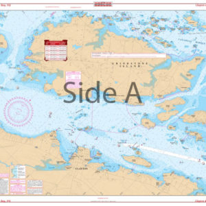
San Francisco Bay Navigation Chart 52
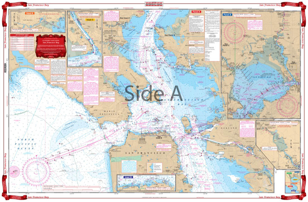
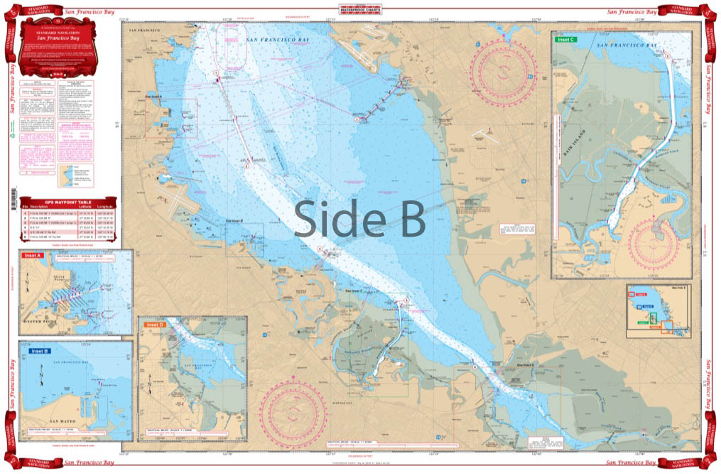
The Area Covered
$32.95
Covers the entire Bay area from Vallejo and San Pablo Bay south to Redwood City and Palo Alto. Also covers west out the main ship channel to the sea buoy. Detailed blow ups are provided for Vallejo and Mare Island, San Rafael, the San Francisco Yacht Harbor and North oint area, Coyote Point in San Mateo, Redwood Creek, Oyster Point and Sierra Point. Red Indicators for fuel docks.
The Area Covered
Covers the entire Bay area from Vallejo and San Pablo Bay south to Redwood City and Palo Alto. Also covers west out the main ship channel to the sea buoy. Detailed blow ups are provided for Vallejo and Mare Island, San Rafael, the San Francisco Yacht Harbor and North oint area, Coyote Point in San Mateo, Redwood Creek, Oyster Point and Sierra Point. Red Indicators for fuel docks. This map of San Francisco Bay area will help guide your journey through these waters. This navigation map covers the entire San Francisco Bay area from Vallejo and San Pablo Bay south to Redwood City and Palo Alto. Also covers west out through the main ship channel to the sea buoy. Detailed blow ups are provided for Vallejo and Mare Island, San Rafael, the San Francisco Yacht Harbor and North Point area, Coyote Point in San Mateo, Redwood Creek, Oyster Point and Sierra Point. Red indicators will help you locate fuel docks. If you are in need of a gift or have an open space on your wall, framed nautical charts are a perfect buy. Information from 4 NOAA Charts: #18651, #18651, #18649, and #18650. Nautical Chart is 25" X 38". WGS84 - World Mercator Datum.
Additional information
| Dimensions | 24 × 36 in |
|---|