South Lake Huron and Saginaw Bay Navigation Chart 74
The Area Covered
$32.95
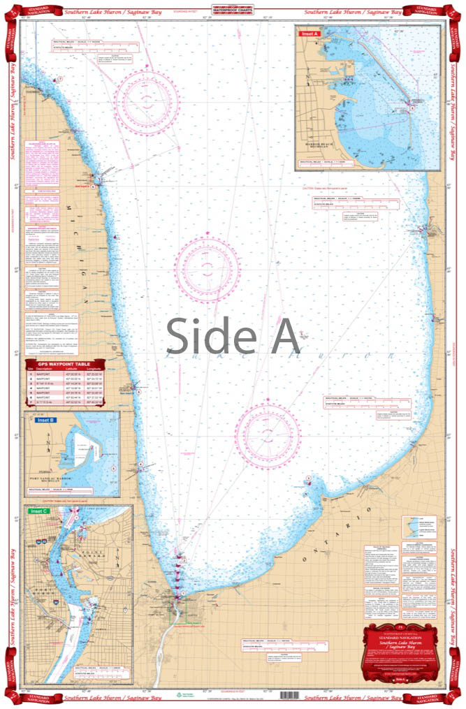
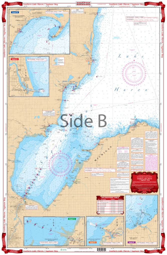
Coverage from Port Huron north along the Michigan Shore to north of Harbor Beach with details of Port Huron, Harbor Beach, and Sanilac Harbor on one side. The reverse side has complete coverage of Saginaw Bay to Bay City, north to Au Sable, with enlarged detailed harbor blow ups for Port Austin, Caseville Harbor, Sebewaing Harbor, Oscoda, and Tawas Bay.
The Area Covered
Coverage from Port Huron north along the Michigan Shore to north of Harbor Beach with details of Port Huron, Harbor Beach, and Sanilac Harbor on one side. The reverse side has complete coverage of Saginaw Bay to Bay City, north to Au Sable, with enlarged detailed harbor blow ups for Port Austin, Caseville Harbor, Sebewaing Harbor, Oscoda, and Tawas Bay. If you plan to traverse the southern edge of Lake Huron, you need this nautical map on your vessel. This navigation map has coverage from Port Huron north along the Michigan Shore to north of Harbor Beach with details of Port Huron, Harbor Beach, and Sanilac Harbor on one side. The reverse side has complete coverage of Saginaw Bay to Bay City, north to Au Sable, with enlarged detailed harbor blow ups for Port Austin, Caseville Harbor, Sebewaing Harbor, Oscoda, and Tawas Bay. You will enjoy the time you spend plotting a trip when you use this marine map. Get this Lake Huron map framed and display it in your office or home. Information from 3 NOAA Charts: #14863, #14862 and #14852. Chart is 25" X 38". WGS84 - World Mercator Datum.
Additional information
| Dimensions | 24 × 36 in |
|---|