
U.S. Virgin Islands – Large Print Navigation Chart 132E
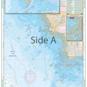
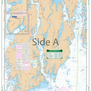
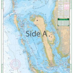
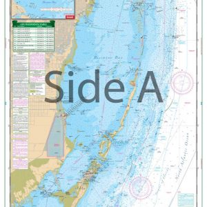
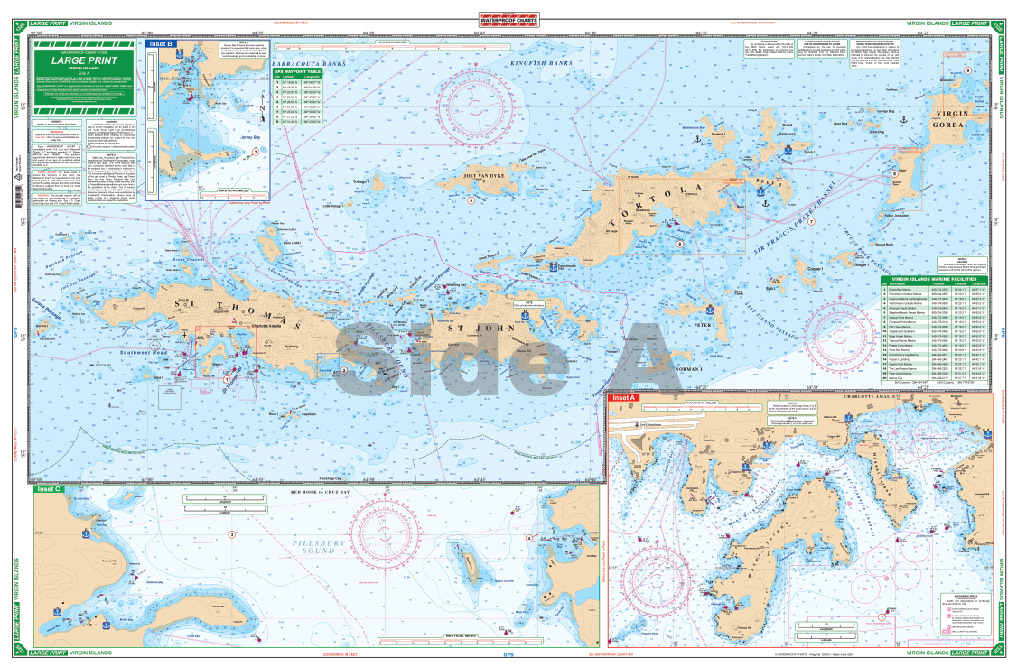
The Area Covered
$34.95
Perfect for bareboat chartering, this excellent chart has unique features which make it more current and different than other coverage of this popular cruising destination. All depth soundings are in feet. The panels and insets have been chosen to show the most popular ports and cruising destinations. A current list of marinas with their phone number and GPS positions is on both sides with the marina positions plotted.
The Area Covered
Perfect for bareboat chartering, this excellent chart has unique features which make it more current and different than other coverage of this popular cruising destination. All depth soundings are in feet. The panels and insets have been chosen to show the most popular ports and cruising destinations. A current list of marinas with their phone number and GPS positions is on both sides with the marina positions plotted. GPS Waypoints for popular routes and approaches are listed and indexed and customs office locations are shown for both US and British ports of entry. Side A has coverage of St. Thomas east to Virgin Gorda with detailed blow ups for St. Thomas harbor, Jersey and Benner Bay, Red Hook and Cruz Bay. Side B covers East Tortola from Road Harbour to Virgin Gorda and continues to Anegada including expanded blown up detailed insets for Nanny Cay and Road Town, South Virgin Gorda, The Baths, Virgin Gorda Yacht Harbor, and Gorda Sound including The Bitter End, Biras Creek and Leverick Bay. Complete approach channel information for Anegada is shown. Overall, this is the best coverage possible on a single two-sided chart. Note; #132E does not include St. Croix or St. Croix harbors. For coverage of St. Croix see #32. If you're heading for your dream vacation, you have to bring along this US Virgin Islands map. Perfect for bareboat chartering, this excellent navigation chart has unique features which make it more current and unique than other coverage of this popular cruising destination. All depth soundings are measured in feet. The panels and insets have been chosen to show the most popular ports and cruising destinations. A current list of marinas with their phone numbers and GPS positions is located on both sides, along with the marina positions plotted on the nautical chart. GPS Waypoints for popular routes and approaches are listed and indexed, and customs office locations are shown for both US and British ports of entry. Side A has coverage of St. Thomas east to Virgin Gorda with detailed areas for St. Thomas harbor, Jersey and Benner Bay, Red Hook and Cruz Bay. Side B covers East Tortola from Road Harbour to Virgin Gorda and continues to Anegada including expanded blown up detailed insets for Nanny Cay and Road Town, South Virgin Gorda, The Baths Virgin Gorda, Virgin Gorda Yacht Harbor, and Gorda Sound including The Bitter End, Biras Creek and Leverick Bay. Complete approach channel information for Anegada is shown. Overall, this is the best coverage possible on a single two-sided nautical map. Note; #132E does not include St. Croix or St. Croix harbors. For coverage of St. Croix see #32. Information from 5 government marine charts: 25647, 25649, 25641, 25605, 25611 and private sources. Nautical chart is 25" X 38". WGS84 - World Mercator Datum.
Additional information
| Weight | 0.2 oz |
|---|---|
| Dimensions | 24 × 36 in |