Hilton Head and Beaufort, SC – Large Print Navigation Chart 93E
The Area Covered
$32.95
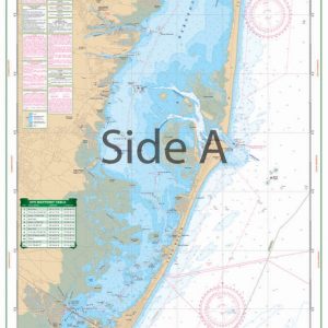
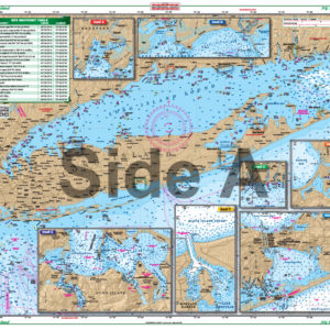
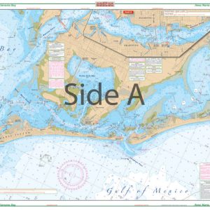
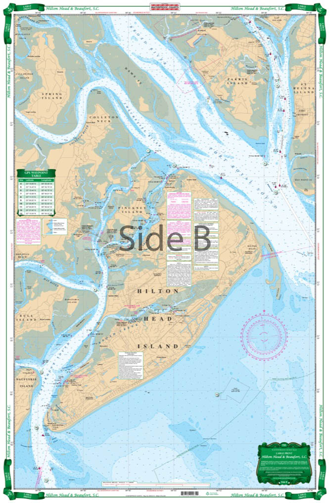
Best detail and easiest to read coverage of the local area for Calibogue Sound, Hilton Head Island north to Beaufort and the Coosaw River. Includes Morgan River and Dataw Island. Details the local waters of Hilton Head with bold colors. GPS Waypoints on both sides guide you across open water. Latitude and Longitude grid makes it easy to find your position and simple to set up your GPS.
The Area Covered
Best detail and easiest to read coverage of the local area for Calibogue Sound, Hilton Head Island north to Beaufort and the Coosaw River. Includes Morgan River and Dataw Island. Details the local waters of Hilton Head with bold colors. GPS Waypoints on both sides guide you across open water. Latitude and Longitude grid makes it easy to find your position and simple to set up your GPS. Major roads have been added to make chart more useable. This chart is especially well suited for framing for Hilton Head or Beaufort boaters and visitors. This is the most highly detailed and easiest to read coverage of the local area for Calibogue Sound, Hilton Head Island north to Beaufort and the Coosaw River available. This navigation chart includes Morgan River and Dataw Island. Details are included for the local waters of Hilton Head with bold colors. GPS Waypoints on both sides guide you across open water. The Latitude and Longitude grid makes it easy to find your position and simple to set up your GPS. Major roads have been added to make this marine map more useable. This nautical map is especially well suited for framing for Hilton Head or Beaufort boaters and visitors. Information from 3 NOAA charts: #11516, #11519 and #11513. Nautical Chart is 25" X 38". WGS84 - World Mercator Datum.
Additional information
| Weight | 0.2 oz |
|---|---|
| Dimensions | 24 × 36 in |