
Whitewater Bay and Everglades Inshore Fishing Chart 40F
The Area Covered
$32.95
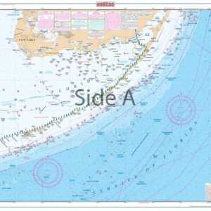
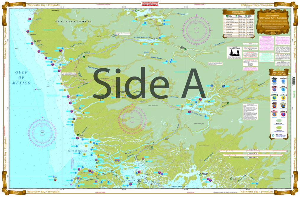
Complete coverage from Garfield Bight (just east of Flamingo) to Little Shark River with Large Print detail for all of Whitewater Bay on side B. On the reverse Side A you get coverage from Little Shark River to Highlands Beach (just east of Lostmans River) with excellent detail of Broad River, Harney River, Tarpon Bay and lots more. Like all of our Inshore Fishing Charts this special chart details all of the major fishing areas with species specific locations.
THIS IS A FOLDED CHART. CAN BE SHIPPED ROLLED UPON REQUEST.
The Area Covered
Complete coverage from Garfield Bight (just east of Flamingo) to Little Shark River with Large Print detail for all of Whitewater Bay on side B. On the reverse Side A you get coverage from Little Shark River to Highlands Beach (just east of Lostmans River) with excellent detail of Broad River, Harney River, Tarpon Bay and lots more. Like all of our Inshore Fishing Charts this special chart details all of the major fishing areas with species specific locations. For the Kayaker and Campers we have listed all of the Park Camping Sites with GPS Coordinates and we have highlighted the Wilderness Waterway, as well as the CANOE TRAIL from Coot Bay to East Cape Canal. This is a Chart you can have as much fun at home planning your next adventure or remembering the last trip there. NO ONE HAS A BETTER CHART OF THE EVERGLADES. No ONE !!!!! We have your Everglades fishing needs covered! Hook, line, and sinker. Complete coverage on this fishing chart runs from Garfield Bight (just east of Flamingo) to Little Shark River with large print detail for all of Whitewater Bay on side B. On the reverse Side A you have coverage from Little Shark River to Highlands Beach (just east of Lostmans River) with excellent detail of Broad River, Harney River, Tarpon Bay and lots more. Like all of our Inshore Fishing Charts this special chart details all of the major fishing areas with species specific locations. For the kayakers and campers we have listed all of the park camping sites with GPS coordinates and we have highlighted the Wilderness Waterway, as well as the Canoe Trail from Coot Bay to East Cape Canal. This is a navigation chart you can use to plan your trip or frame and hang on your wall to remember your nautical adventures. You won't find a better Everglades fishing chart than this one. Nautical Chart is 25" X 38". WGS84 - World Mercator Datum.
Additional information
| Weight | .167 oz |
|---|---|
| Dimensions | 24 × 36 in |