Charleston Harbor – Large Print Navigation Chart 95E
The Area Covered
$32.95
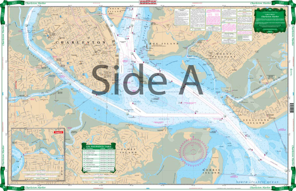
Terrific coverage of this busy area. A bright color scheme has been used to clarify depth contours for the recreational boater. This Large Print chart is exceptionally easy to read and use. Side A covers the entrance to the harbor from the channel and Intracoastal Waterway at Sullivans Island and continues north to the bridges on the Cooper River and northwest past both highway bridges to the abandoned railroad trestle on the Ashley River, including the Battery, Shutes Folley Island and the Mount Pleasant Channel and Shem Creek in the developing Mount Pleasant area.
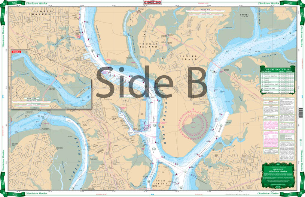
The Area Covered
Terrific coverage of this busy area. A bright color scheme has been used to clarify depth contours for the recreational boater. This Large Print chart is exceptionally easy to read and use. Side A covers the entrance to the harbor from the channel and Intracoastal Waterway at Sullivans Island and continues north to the bridges on the Cooper River and northwest past both highway bridges to the abandoned railroad trestle on the Ashley River, including the Battery, Shutes Folley Island and the Mount Pleasant Channel and Shem Creek in the developing Mount Pleasant area. This chart also covers the continuation of Wappoo Creek and details the ICW west to Elliot Cut and the confluence with the Stono River. Side B continues upriver to the Navy Yard and Coulter Creek; up the Wando River to the highway bridge and Rathall Creek; and up the Ashley River to the Drayton Bridge. 21 GPS Waypoints are plotted to help navigate the harbor and rivers. This Charleston Harbor navigation map provides terrific coverage of this busy area. A bright color scheme has been used to clarify depth contours for the recreational boater, and also makes it excellent for framing. This large print nautical map is exceptionally easy to read and use. Side A covers the entrance to the Charleston Harbor from the channel and Intracoastal Waterway at Sullivans Island and continues north to the bridges on the Cooper River and northwest past both highway bridges to the abandoned railroad trestle on the Ashley River, including the Battery, Shutes Folley Island and the Mount Pleasant Channel and Shem Creek in the developing Mount Pleasant area. This navigation chart also covers the continuation of Wappoo Creek and details the Intracoastal Waterway west to Elliot Cut and the confluence with the Stono River. Side B continues upriver to the Navy Yard and Coulter Creek; up the Wando River to the highway bridge and Rathall Creek; and up the Ashley River to the Drayton Bridge. On this marine map, 21 GPS Waypoints are plotted to help navigate the harbor and rivers. Information from NOAA Chart #11524. Nautical Chart is 25" X 38". WGS84 - World Mercator Datum.
Additional information
| Weight | 0.2 oz |
|---|---|
| Dimensions | 24 × 36 in |