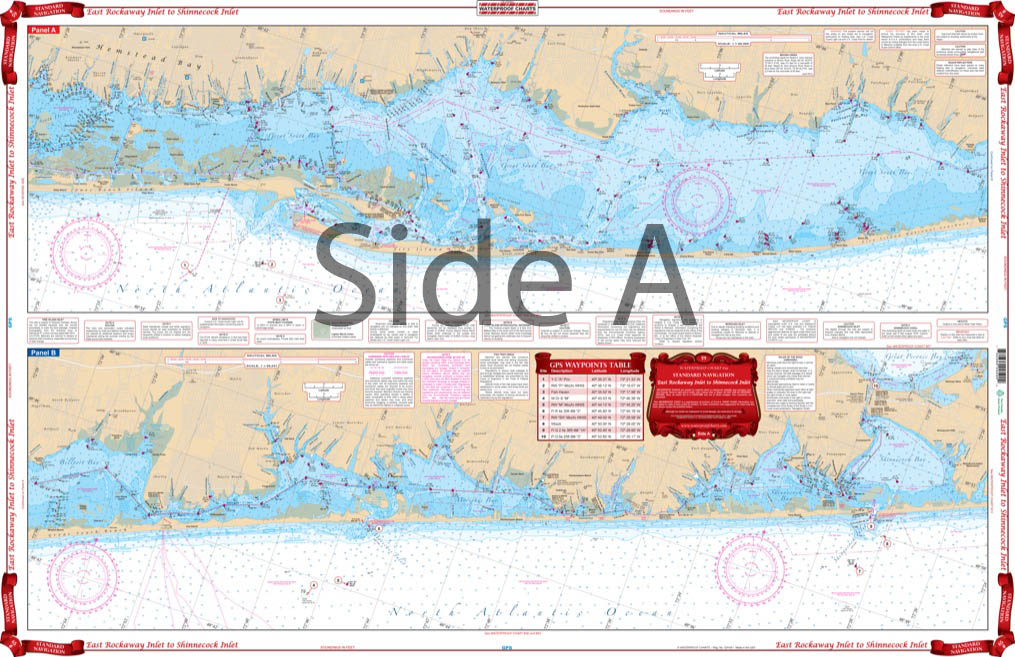
East Rockaway Inlet to Shinnecock Inlet Navigation Chart 59
The Area Covered
$32.95
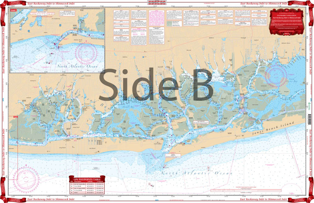
This chart provides coverage from Far Rockaway and Atlantic Beach to South Oyster Bay on the west panel. The east panel covers from Oyster Bay East through Great South Bay, Moriches Bay to Shinnecock Bay, and the Shinnecock Canal. Covers approximately 1 mile offshore. Boaters, kayakers, fishermen, and those who just love the water will want this New York nautical chart. This navigation chart provides coverage from Far Rockaway and Atlantic Beach to South Oyster Bay on the west panel.
The Area Covered
This chart provides coverage from Far Rockaway and Atlantic Beach to South Oyster Bay on the west panel. The east panel covers from Oyster Bay East through Great South Bay, Moriches Bay to Shinnecock Bay, and the Shinnecock Canal. Covers approximately 1 mile offshore. Boaters, kayakers, fishermen, and those who just love the water will want this New York nautical chart. This navigation chart provides coverage from Far Rockaway and Atlantic Beach to South Oyster Bay on the west panel. The east panel covers from Oyster Bay East through Great South Bay, Moriches Bay to Shinnecock Bay, and the Shinnecock Canal. It covers approximately 1 mile offshore. This navigation map makes for a great gift or piece of wall art when framed. Information from NOAA Chart #12352. Nautical Chart is 25" X 38". WGS84 - World Mercator Datum.
Additional information
| Dimensions | 24 × 36 in |
|---|