Hilton Head and Beaufort Inshore Fishing Chart 93F
The Area Covered
$32.95
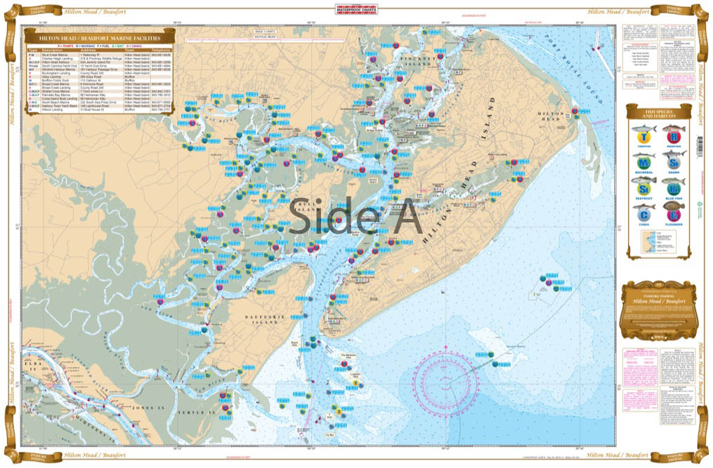
Complete Inshore coverage from Coosaw River to Hilton Head and Daufuskie Island. Detail of all backwater creeks and flats. This special chart details all of the Oyster Rakes along with mud flats, showing specific areas for the species caught in the area: Cobia, Redfish, Trout, Mackerel, Flounder, Sharks, and Tarpon.
THIS IS A FOLDED CHART. CAN BE SHIPPED ROLLED UPON REQUEST.
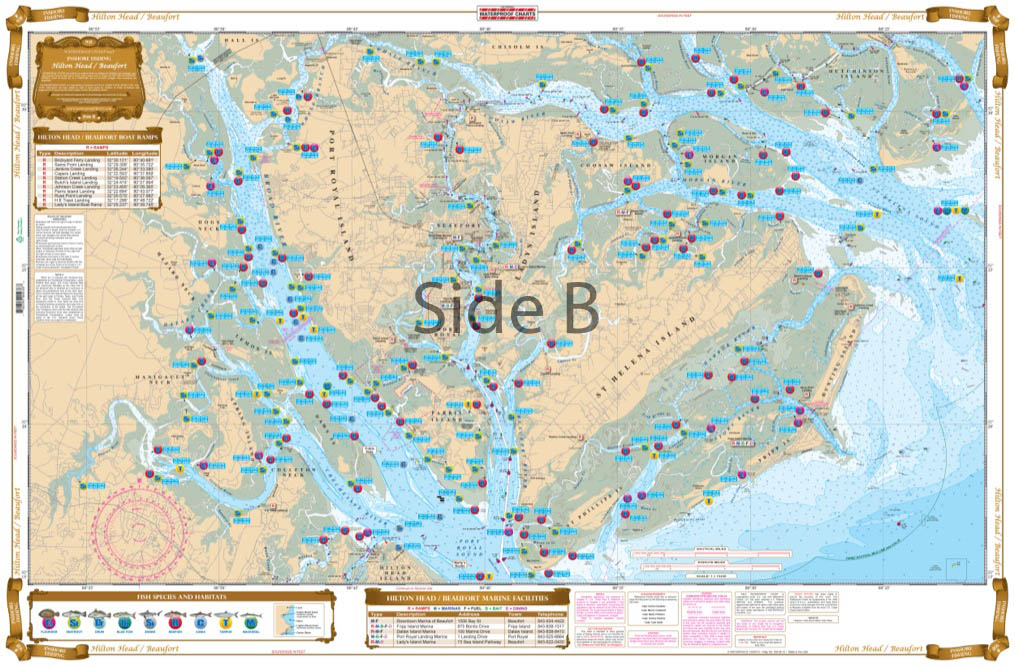
The Area Covered
Complete Inshore coverage from Coosaw River to Hilton Head and Daufuskie Island. Detail of all backwater creeks and flats. This special chart details all of the Oyster Rakes along with mud flats, showing specific areas for the species caught in the area: Cobia, Redfish, Trout, Mackerel, Flounder, Sharks, and Tarpon. This chart also includes a complete list of all area boat ramps with GPS Coordinates for use on your car's GPS. Information from 4 NOAA Charts: #11512, #11513, #11516, and #11517. If you are planning on fishing in the Hilton Head and/or Beaufort area, you will need this chart. Your Hilton Head fishing trip has now gotten better! We make sure to pack each of our fishing charts to the brim with as much information as possible. We speak to local charter fishing captains to obtain the best locations for finding fish. Our fishing chart includes complete inshore coverage from Coosaw River to Hilton Head and Daufuskie Island. There are also details of all backwater creeks and flats. This special navigation chart details all of the Oyster Rakes along with mud flats, showing specific areas for the species caught in the area: Cobia, Redfish, Trout, Mackerel, Flounder, Sharks, and Tarpon. This marine map also includes a complete list of all area boat ramps with GPS Coordinates for use on your car's GPS. If you are planning on fishing in the Hilton Head or Beaufort area, you will need this nautical map. Information from 4 NOAA Charts: #11512, #11513, #11516, and #11517. Nautical Chart is 25" X 38". WGS84 - World Mercator Datum.
Additional information
| Dimensions | 24 × 36 in |
|---|