Upper Florida Keys Navigation Chart 33
The Area Covered
$32.95
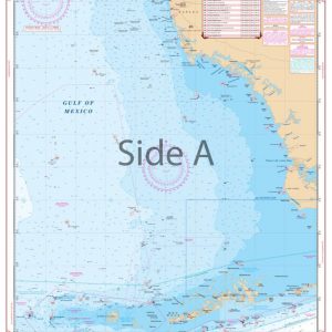
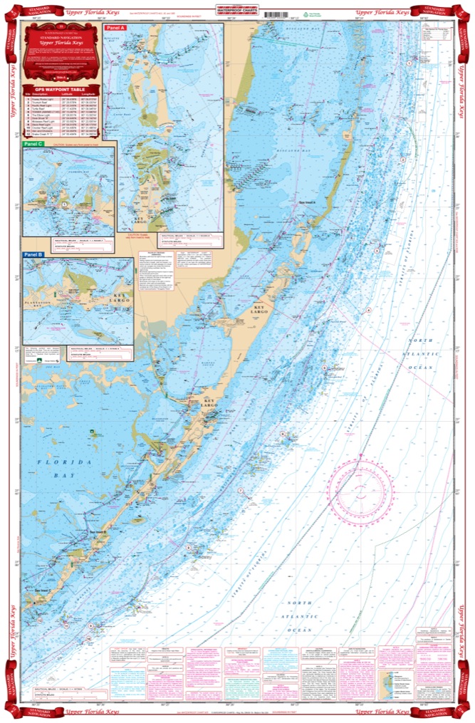
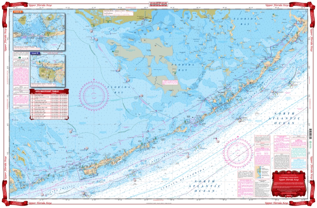
From Soldier Key and Black Point in Biscayne Bay. This chart covers the entire area south to Marathon with both detailed Intracoastal Waterway coverage and offshore coverage showing complete reef details. It also includes complete coverage of Florida Bay and the Flamingo Area. It has expanded detail insets for North Key Largo, Windley Key (Holiday Isles) Area, Tavenier, Indian Key Area, Marathon and Flamingo. Contains a total of 15 plotted and indexed GPS Waypoints.
The Area Covered
From Soldier Key and Black Point in Biscayne Bay. This Upper Florida Keys chart covers the entire area south to Marathon with both detailed Intracoastal Waterway coverage and offshore coverage showing complete reef details. This navigation chart also includes complete coverage of Florida Bay, and the Flamingo area. The marine map has expanded detail insets for North Key Largo, Windley Key (Holiday Isles) Area, Tavenier, Indian Key Area, Marathon and Flamingo. Also included in this fine nautical chart is a total of 15 plotted and indexed GPS Waypoints. Now you can finally take that dream journey, boating to the Florida Keys!
Additional information
| Dimensions | 24 × 36 in |
|---|