×
  • CONTACT
0 Items
  • Charts By Region
    • Bahamas
    • California to Mexico
    • Cape Cod, New York and Vermont
    • Caribbean
    • Florida
    • Georgia to the Carolinas
    • Great Lakes
    • Gulf Coast
    • Maine to Boston
    • New York to New Jersey
    • Pacific Northwest
    • Virginia and Chesapeake Bay
  • Charts By Style
    • Bathymetric
    • Chart Kits
    • Chart Storage
    • Coastal Fishing
    • Custom 11 x 17 Boat Rentals
    • Custom 11 x 17 – Races & Regattas
    • Inshore Fishing
    • Lake Fishing
    • Large Print Navigation
    • Offshore Fish/Dive
    • Satellite Charts
    • Standard Navigation
    • Vintage Charts
  • Wall Art
    • Canvas Art
    • City Canvas Art
    • Framed Charts
    • Vintage Charts
  • Chart Plotting Tools
    • Basic Navigation Set
    • Chart Storage
  • More
    • About
    • Blog
      • Boating Buoys and What They Mean
      • How to Read a Nautical Chart
      • Ship Markings & What They Mean
    • Contact Us
    • Dealer
      • 11 x 17 Boat Rentals
      • 11 x 17 Races & Regattas
      • How to Become a Dealer
      • Refund and Returns Policy
    • Refund and Returns Policy
Home / Framing Offered / Page 16

Framing Offered

Showing 136–144 of 160 results

  • San_Juan_Islands_Navigation_Map_43_SIde_A

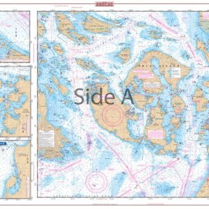
    San Juan Islands Navigation Chart 43

    $32.95
  • Sanibel_to_Lower_Keys_Offshore_Fish_and_Dive_Map_9F_Side_A

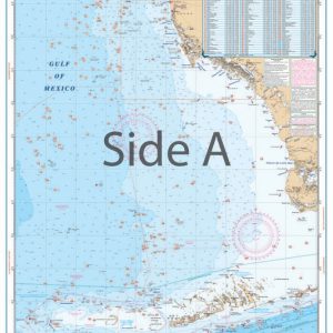
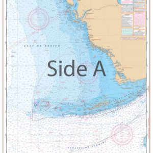
    Sanibel to Lower Keys Offshore Fish and Dive Chart 9F

    $32.95
  • Sale! Santa_Barbara_Channel_Navigation_Map_82_Side_A

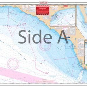
    Santa Barbara Channel Navigation Chart 82

    $32.95 Original price was: $32.95.$22.95Current price is: $22.95.
  • Sarasota_Bay_Inshore_Fishing_Map_21F_Side_A

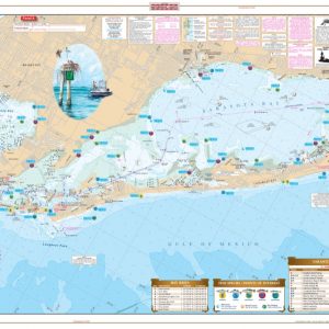
    Sarasota Bay Inshore Fishing Chart 21F

    $32.95
  • Savannah_to_St._Catherine’s_Sound_Inshore_Fishing_Map_97F_Side_A

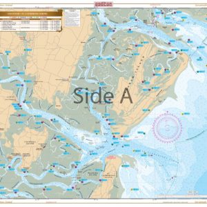
    Savannah to St. Catherine’s Sound Inshore Fishing Chart 97F

    $32.95
  • South_Florida_Maxi_Navigation_Map_35_Side_A

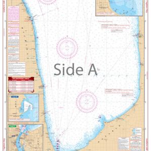
    South Florida Maxi Navigation Chart 35

    $32.95
  • South_Lake_Huron_and_Saginaw_Bay_Navigation_Chart_74_Side_A

    South Lake Huron and Saginaw Bay Navigation Chart 74

    $32.95
  • Southeast_Florida_Swordfish_and_Trolling_Fish_and_Dive_Map_123F_Side_A

    Southeast Florida Swordfish and Trolling Fish and Dive Chart 123F

    $32.95
  • Southern_California_and_Baja_Offshore_Fish_and_Dive_Map_88F_Side_A

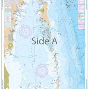
    Southern California and Baja Offshore Fish and Dive Chart 88F

    $32.95
  • ←
  • 1
  • 2
  • 3
  • …
  • 13
  • 14
  • 15
  • 16
  • 17
  • 18
  • →
×
Waterproof Charts Logo

CONTACT

Toll Free : 1-800-423-9026
Phone : 1-941-639-7626

LOCATION

1460 Atlantic Blvd.
Auburn Hills, MI 48326

EMAIL

sales@waterproofcharts.com
info@waterproofcharts.com



Made in the USA

Waterproof Charts Logo

CONTACT

Toll Free : 1-800-423-9026
Phone : 1-941-639-7626

LOCATION

1460 Atlantic Blvd.
Auburn Hills, MI 48326

EMAIL

sales@waterproofcharts.com
info@waterproofcharts.com



Made in the USA