×
  • CONTACT
0 Items
  • Charts By Region
    • Bahamas
    • California to Mexico
    • Cape Cod, New York and Vermont
    • Caribbean
    • Florida
    • Georgia to the Carolinas
    • Great Lakes
    • Gulf Coast
    • Maine to Boston
    • New York to New Jersey
    • Pacific Northwest
    • Virginia and Chesapeake Bay
  • Charts By Style
    • Bathymetric
    • Chart Kits
    • Chart Storage
    • Coastal Fishing
    • Custom 11 x 17 Boat Rentals
    • Custom 11 x 17 – Races & Regattas
    • Inshore Fishing
    • Lake Fishing
    • Large Print Navigation
    • Offshore Fish/Dive
    • Satellite Charts
    • Standard Navigation
    • Vintage Charts
  • Wall Art
    • Canvas Art
    • City Canvas Art
    • Framed Charts
    • Vintage Charts
  • Chart Plotting Tools
    • Basic Navigation Set
    • Chart Storage
  • More
    • About
    • Blog
      • Boating Buoys and What They Mean
      • How to Read a Nautical Chart
      • Ship Markings & What They Mean
    • Contact Us
    • Dealer
      • 11 x 17 Boat Rentals
      • 11 x 17 Races & Regattas
      • How to Become a Dealer
      • Refund and Returns Policy
    • Refund and Returns Policy
Home / Framing Offered / Page 4

Framing Offered

Showing 28–36 of 160 results

  • Charleston_Harbor_–_Large_Print_Navigation_Map_95E_Side_A

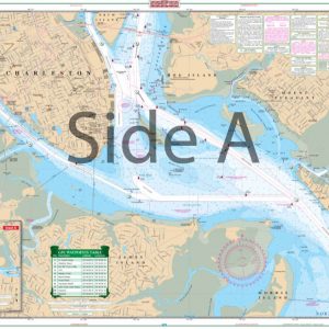
    Charleston Harbor – Large Print Navigation Chart 95E

    $32.95
  • Charleston_Harbor_to_Myrtle_Beach_Navigation_Map_98_Side_A

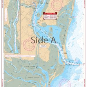
    Charleston Harbor to Myrtle Beach Navigation Chart 98

    $32.95
  • Charleston_Light_–_Cape_Canaveral_Navigation_Map_36_Side_A

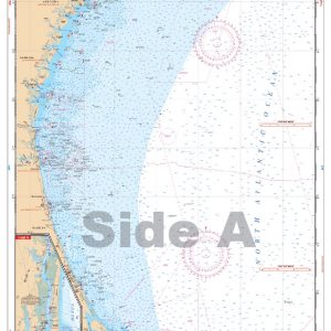
    Charleston Light – Cape Canaveral Navigation Chart 36

    $32.95
  • Charleston_SC_Navigation_Map_95_Side_A

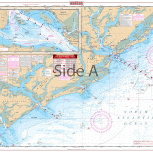
    Charleston SC Navigation Chart 95

    $32.95
  • Charlotte_Harbor_and_Lemon_Bay_Inshore_Fishing_Chart_1F_Side_A

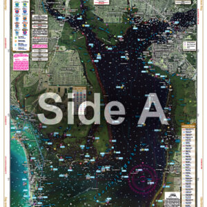
    Charlotte Harbor and Lemon Bay Inshore Fishing Chart 1F

    $32.95
  • Charlotte_Harbor_and_Pine_Island_Sound_Large_Print_Navigation_Map_1E_Side_A

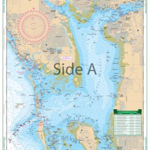
    Charlotte Harbor and Pine Island Sound Large Print Navigation Chart 1E

    $32.95
  • Chatham_,_Pleasant_Bay_,_and_Monomoy_Island_Large_Print_Navigation_Map_50E_Side_A

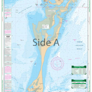
    Chatham, Pleasant Bay, and Monomoy Island Large Print Navigation Chart 50E

    $32.95
  • Chicago_and_Lake_Michigan_Navigation_Map_70_Side_A

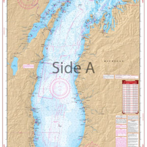
    Chicago and Lake Michigan Navigation Chart 70

    $32.95
  • Clayton_and_Alexandria_Bay_Navigation_Map_140_Side_A

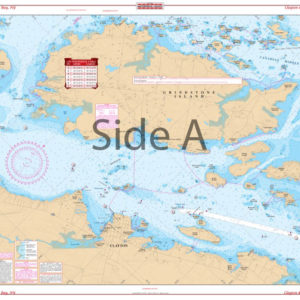
    Clayton and Alexandria Bay Navigation Chart 140

    $32.95
  • ←
  • 1
  • 2
  • 3
  • 4
  • 5
  • 6
  • 7
  • …
  • 16
  • 17
  • 18
  • →
×
Waterproof Charts Logo

CONTACT

Toll Free : 1-800-423-9026
Phone : 1-941-639-7626

LOCATION

1460 Atlantic Blvd.
Auburn Hills, MI 48326

EMAIL

sales@waterproofcharts.com
info@waterproofcharts.com



Made in the USA

Waterproof Charts Logo

CONTACT

Toll Free : 1-800-423-9026
Phone : 1-941-639-7626

LOCATION

1460 Atlantic Blvd.
Auburn Hills, MI 48326

EMAIL

sales@waterproofcharts.com
info@waterproofcharts.com



Made in the USA