×
  • CONTACT
0 Items
  • Charts By Region
    • Bahamas
    • California to Mexico
    • Cape Cod, New York and Vermont
    • Caribbean
    • Florida
    • Georgia to the Carolinas
    • Great Lakes
    • Gulf Coast
    • Maine to Boston
    • New York to New Jersey
    • Pacific Northwest
    • Virginia and Chesapeake Bay
  • Charts By Style
    • Bathymetric
    • Chart Kits
    • Chart Storage
    • Coastal Fishing
    • Custom 11 x 17 Boat Rentals
    • Custom 11 x 17 – Races & Regattas
    • Inshore Fishing
    • Lake Fishing
    • Large Print Navigation
    • Offshore Fish/Dive
    • Satellite Charts
    • Standard Navigation
    • Vintage Charts
  • Wall Art
    • Canvas Art
    • City Canvas Art
    • Framed Charts
    • Vintage Charts
  • Chart Plotting Tools
    • Basic Navigation Set
    • Chart Storage
  • More
    • About
    • Blog
      • Boating Buoys and What They Mean
      • How to Read a Nautical Chart
      • Ship Markings & What They Mean
    • Contact Us
    • Dealer
      • 11 x 17 Boat Rentals
      • 11 x 17 Races & Regattas
      • How to Become a Dealer
      • Refund and Returns Policy
    • Refund and Returns Policy
Home / Standard Navigation / Page 5

Standard Navigation

Showing 37–45 of 89 results

  • Jacksonville_and_St._Johns_River_Navigation_Chart_37_Side_A

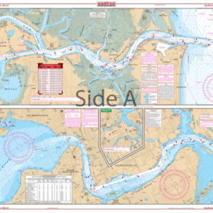
    Jacksonville and St. Johns River Navigation Chart 37

    $32.95
  • Lake_Okeechobee_Stuart_to_Fort_Myers_Beach_Crossing_Navigation_Map_20_Side_A

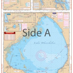
    Lake Okeechobee Stuart to Fort Myers Beach Crossing Navigation Chart 20

    $32.95
  • Lake_Ontario_–_Northeast_Lake_Ontario_Navigation_Map_76_Side_A

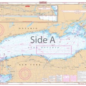
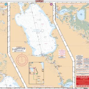
    Lake Ontario – Northeast Lake Ontario Navigation Chart 76

    $32.95
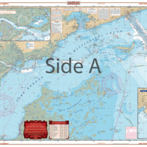
  • Lake Ponchartrain to Gulfport Navigation Chart 40

    $32.95
  • Lake_St._Clair_and_St._Clair_River_Navigation_Map_29_Side_A

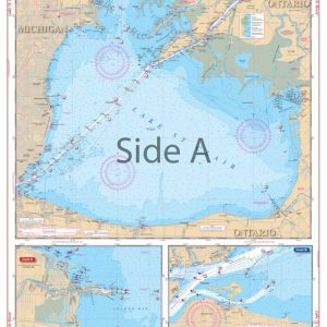
    Lake St. Clair and St. Clair River Navigation Chart 29

    $32.95
  • Long_Island_Sound_Navigation_Map_13_Side_A

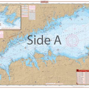
    Long Island Sound Navigation Chart 13

    $32.95
  • Lostmans_River_to_Whitewater_Bay_Navigation_Map_39_Side_A

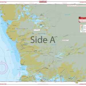
    Lostmans River to Whitewater Bay Navigation Chart 39

    $32.95
  • Lower_Florida_Keys_Navigation_Map_34_Side_A

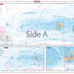
    Lower Florida Keys Navigation Chart 34

    $32.95
  • Lower St. John's River

    Lower St. John’s River Navigation Chart 37S – DISCONTINUED

    $32.95
  • ←
  • 1
  • 2
  • 3
  • 4
  • 5
  • 6
  • 7
  • 8
  • 9
  • 10
  • →
×
Waterproof Charts Logo

CONTACT

Toll Free : 1-800-423-9026
Phone : 1-941-639-7626

LOCATION

1460 Atlantic Blvd.
Auburn Hills, MI 48326

EMAIL

sales@waterproofcharts.com
info@waterproofcharts.com



Made in the USA

Waterproof Charts Logo

CONTACT

Toll Free : 1-800-423-9026
Phone : 1-941-639-7626

LOCATION

1460 Atlantic Blvd.
Auburn Hills, MI 48326

EMAIL

sales@waterproofcharts.com
info@waterproofcharts.com



Made in the USA